
Brace for Impact: Major Winter Storm to Slam California and Nevada
A powerful and potentially historic winter storm is poised to unleash heavy snow, fierce winds, and treacherous travel conditions across the Sierra Nevada region, impacting California and Nevada throughout the coming week. Forecasters are predicting a significant weather event, potentially the strongest system to hit the area since around Christmastime.
What to Expect: Snowfall Totals and Wind Gusts
The weather forecast calls for substantial snowfall accumulations, particularly along the Sierra crest, including Donner Pass. Total snowfall could range from 4 to 8 feet in the highest elevations by Wednesday, February 18th. The heaviest snowfall is anticipated between Monday afternoon, February 16th, and Tuesday, February 17th.
- Sierra Crest: 4-8 feet of snow
- Lake Tahoe Basin: 18-30 inches at lake level, with higher amounts along the West Shore and in Alpine County
- Reno/Carson Area: Potential for 2+ inches of snow by Monday night
In addition to the heavy snow, strong winds are expected, with gusts between 45 and 55 mph. Sierra ridges could experience even more intense gusts, exceeding 100 mph. These powerful winds, combined with the heavy snowfall, will likely create periods of whiteout conditions, severely reducing visibility.
Travel Impacts and Safety Precautions
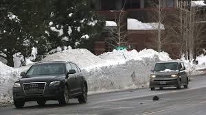
Travel across the Sierra Nevada will be significantly impacted. Donner Pass and Interstate 80, along the west slope of the Northern Sierra, are expected to bear the brunt of the storm. Winter storm watches are currently in effect from Sunday evening, February 15th, through Wednesday evening, February 18th.
Here’s what travelers should know:
- Chain Controls: Likely along I-80.
- Road Closures: Possible during peak snowfall.
- Presidents Day Weekend Travel: Drivers are strongly urged to travel before Sunday evening to avoid being stranded.
The National Weather Service in Reno has issued a winter storm warning for the greater Lake Tahoe area. Residents and visitors are advised to closely monitor the latest forecasts and consider delaying travel if possible. Downed trees and power lines are also a concern due to the strong winds. You can find up-to-date information from the National Weather Service.
Reno and Surrounding Areas
Reno is expected to begin with rain before colder air arrives early next week. Snow could reach the valley floor by Monday night. Foothill communities and Virginia City have a higher probability of accumulating snow. Even if Reno receives less snow than the Sierra, slick roads and slow travel are possible.
Stay safe and prepared! This winter storm is a serious event, and taking precautions is crucial for ensuring your well-being.
For more information on winter weather preparedness, visit Ready.gov.


