Weather Today: New Jersey Braces for Second Winter Storm
New Jersey residents are preparing for a second winter storm this weekend, with widespread snowfall totals of 2 to 5 inches forecast for Sunday. Snow began falling before sunrise and is expected to continue throughout the day, impacting travel and daily life across the state.
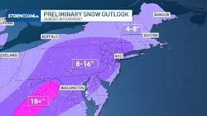
Storm Details & Snowfall Predictions
The National Weather Service (NWS) anticipates a potential lull in snowfall around midday, followed by heavier accumulations in the afternoon. Winter weather advisories have been expanded to cover 17 New Jersey counties, with slightly increased snowfall projections.
- I-95 Corridor & North/West: Widespread 2 to 5 inches expected.
- Bergen, Essex, Hudson, Passaic, & Union Counties: 3 to 5 inches (Advisory until midnight).
- Camden, Gloucester, Salem & NW Burlington Counties: 2 to 4 inches (Advisory until 8 p.m.).
- Hunterdon, Mercer, Morris, Middlesex, Somerset & W Monmouth Counties: 2 to 5 inches (Advisory until 8 p.m.).
- Sussex & Warren Counties: 2 to 4 inches (Advisory until 8 p.m.).
This latest storm follows a snowfall event on Saturday that left parts of northern New Jersey with 3 to 5 inches, particularly in Warren and Sussex counties. The current coastal storm is expected to heavily impact central and northeastern New Jersey.
Icy Conditions & Deep Freeze
The NWS warns of potential refreezing on untreated surfaces overnight as temperatures plummet after 7-8 p.m., creating slick and hazardous conditions. Following the snow, a significant cold snap is expected, with the coldest temperatures arriving Monday night through Tuesday night.
Here’s a breakdown of the expected temperatures:
- Monday Night: Wind chills around zero degrees in some locations.
- Tuesday: Highs in the 20s, with wind chills in the single digits to low teens.
- Tuesday Night: Lows in the single digits, though calmer winds will lessen wind chill severity.
Looking Ahead
The bitter cold will begin to subside on Wednesday, with temperatures moderating towards more seasonal levels. By Thursday, temperatures may even rise above normal. However, a cold front late in the week will bring temperatures back down to near or slightly below normal. The weather pattern may become more active next weekend, though details remain uncertain.
Stay updated with the latest forecasts from the National Weather Service and local news sources.
Note: Advance Local Express Desk utilizes AI tools to assist in content creation, with all content reviewed and edited by staff.