
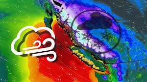
Vancouver Weather: Prepare for a Major Winter Storm
British Columbia is bracing for a significant winter storm late Wednesday and into Thursday, with dangerous conditions expected along highway passes. Following a snowy Tuesday across the South Coast, another potent low-pressure system is set to arrive, bringing a combination of strong winds and heavy alpine snow. This will create extremely hazardous travel conditions, and postponing non-essential trips is strongly advised.
Travel Disruptions Expected
Travellers planning to use major highway passes should seriously consider postponing their journeys. Blizzard conditions are possible, particularly east of the Lower Mainland. Before venturing out, it’s crucial to check current highway conditions on DriveBC.
Winter Storm Warnings are currently in effect for:
- Coquihalla Highway – Hope to Merritt
- Highway 3 – Hope to Princeton
- Okanagan Connector – Merritt to Kelowna
Environment and Climate Change Canada (ECCC) warns that “Weather in the mountains can change suddenly resulting in hazardous driving conditions.” They urge drivers to adjust to winter driving behaviour, utilize winter tires, and carry chains.
Strong Winds & Potential Power Outages
A low-pressure system will move across Vancouver Island and into the Interior on Wednesday night. Strong winds aloft could reach the surface, producing damaging gusts exceeding 90 km/h across extreme southern Vancouver Island and the Fraser Valley. ECCC has issued wind warnings for these areas.
“Local utility outages are possible,” ECCC states. “Damage to roofs, fences, branches or soft shelters is possible. Parks and forests will likely sustain some damage.”
Heavy Snowfall Forecast
Significant snowfall is forecast across B.C.’s mountains through Thursday. The Coquihalla Pass could receive 20-40 cm of snow, while Allison Pass may see 20-30 cm. Other mountain passes throughout the Interior are expected to receive 10-20 cm. Avoid all non-essential travel during this period to minimize the risk of whiteouts and blizzard conditions.
The snow is expected to ease by late Friday. However, another round of low-elevation snow is possible Thursday evening and overnight as a weak trough moves into Washington State, south of B.C.
Low-Elevation Snow Possible
This setup could bring steady precipitation and wet snow as low as 100 metres in elevation. The Fraser Valley and areas at 100-200 metres above sea level on southern Vancouver Island can expect localized snowfall accumulation.
Stay informed with the latest forecast updates from The Weather Network, Canada’s #1 most trusted weather brand and news source*.
*2026 BrandSpark® Canadian Trust Study & 2026 Pollara Trust in Media Study


