
Quebec Weather Review: How Accurate Were Winter 2025-2026 Forecasts?
As the meteorological winter of 2025-2026 comes to a close, it’s time to look back and assess how well our meteorologists predicted the season. While temperatures largely aligned with expectations, snowfall patterns presented a different story. Let’s dive into a detailed review of the Quebec winter weather and the accuracy of the seasonal outlook.
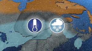
A Cold Winter as Predicted
The forecast for the 2025-2026 winter pointed towards a return to a classic, cold winter – and, generally, that prediction hit the mark. The outlook anticipated below-normal temperatures for western, southern, and central Quebec. Final data confirms this trend, with significant negative anomalies recorded in Sherbrooke (-2°C), Montreal (-1.5°C), and Gatineau (-1.5°C). The overall feeling of cold was reinforced by an early arrival of winter in November.
However, this cold snap settled slightly further south than initially predicted. While near-normal temperatures were expected for eastern Quebec, areas like Gaspé (+1°C) and Sept-Îles (+0.5°C) ended the season slightly above normal. Despite this minor deviation, the frigid scenario materialized for the majority of Quebecers.
Snowfall: Where the Forecast Went Astray
It was in the precipitation department that the forecast diverged from reality. The outlook predicted a snowy winter, with amounts above normal across most of the province. In reality, several sectors experienced significant deficits, notably Saguenay (59% of normal), Quebec City (74%), and Sherbrooke (77%). Gatineau saw a good surplus (116%), but Montreal (102%) was just slightly above normal.
Montreal started strong in the first two months of winter, but February was less generous with snowfall. What explains this discrepancy? The trajectory of weather systems.
The Role of Weather System Paths
The forecast relied on the arrival of powerful low-pressure systems originating from the southwestern United States (Colorado or Texas), laden with moisture. Instead, Quebec experienced the repeated passage of Alberta clippers. These smaller systems from Western Canada brought frequent, but modest, snowfall.
It wasn’t that these powerful systems were absent entirely, but they passed south of our borders. The established cold over Quebec acted as a shield, pushing major low-pressure systems further south. Southern Ontario and the American East Coast felt the brunt of these storms.
Snowfall Totals Elsewhere
Toronto recorded an impressive 160 cm of snow this winter, shattering its normal of 81 cm. The city even experienced its snowiest day ever on January 25th, with up to 56 cm falling in the downtown core. New York and Boston also significantly exceeded their normal snowfall amounts. You can find more information about historical snowfall data at the National Weather Service.
Overall Assessment
In conclusion, the winter 2025-2026 outlook accurately captured the temperature trends, correctly anticipating a return to a classic Quebec winter in stark contrast to the milder winters of recent years. However, the absence of major winter storms led to a miscalculation regarding precipitation. Considering these factors, a grade of B seems reasonable for this seasonal outlook.
With collaboration from Patrick Duplessis, meteorologist.
The most trusted weather information source for Quebecers and Canadians* *According to the 2026 BrandSparkMD Canadian Trust Study and the 2025 Pollara Media Trust Study


