
Flood Watch Issued: Heavy Rain and Severe Storms Threaten Western New York
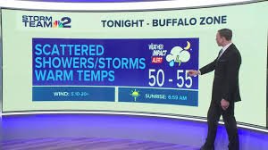
BUFFALO, N.Y. — After a pleasant Monday, conditions are set to change dramatically as shower chances increase during the late evening commute. While the early afternoon drive should remain largely unaffected, those traveling around dinnertime and later will likely encounter scattered showers, potentially including heavy downpours.
These shower chances will become more widespread overnight, with localized downpours and even a few rumbles of thunder possible by early Tuesday morning. Storm Team 2 has issued a Weather Impact Alert for all of Tuesday, anticipating heavy rainfall during the morning commute and another round of intense rain and potentially severe storms in the afternoon. This alert will remain in effect through Wednesday evening, accounting for lingering rainfall and subsequent flooding from runoff.
Warm Temperatures Amidst the Storms
Despite the morning rainfall, temperatures won’t be significantly impacted. In fact, Tuesday’s showers are preceding a warm front that will drive temperatures up throughout the day. Highs are expected to reach at least the 60s, with some areas potentially hitting 70 degrees by late afternoon.
A brief period of relatively dry conditions is expected through midday, offering a chance to enjoy the mild temperatures. However, skies will remain largely cloudy, and any sunshine will only contribute to the warming trend and the development of afternoon storms.
Severe Weather Potential
By late afternoon and early Tuesday evening, shower and thunderstorm chances will return, bringing the potential for severe weather. All of Western New York is under a marginal risk, but Niagara, Erie, Chautauqua, and Cattaraugus counties face a slightly elevated risk.
The primary threat is damaging wind gusts up to 60 miles per hour, capable of downing trees and power lines. Hail up to an inch in diameter is also possible, and while the risk is low, an isolated tornado cannot be ruled out. Ensure you have a reliable way to receive weather alerts.
Flood Concerns and Flood Watch
The heavy rainfall, combined with already saturated ground, raises concerns about river flooding and minor flooding in low-lying areas. The National Weather Service has issued a Flood Watch for all of Western New York, effective through Wednesday evening.
Most areas are expected to receive 1 to 2 inches of rain over the next two days, but localized heavier downpours could result in 2 to 3+ inches. You can find more information about flood safety on the National Weather Service website.
Looking Ahead
The cold front’s passage Tuesday night will bring an end to the worst of the storms, but scattered showers will continue throughout Wednesday, especially in the southern tier. Temperatures will drop, with highs around 50 degrees early Wednesday, falling to the low to mid 40s later in the day.
The rest of the week and the weekend are expected to remain soggy, with daily rain chances. However, temperatures will remain mild, with highs returning to the upper 50s and 60s by Thursday, potentially reaching the 70s early next weekend.
Stay informed with WGRZ+’s 24/7 live radar, satellite views, and hour-by-hour forecasts. Connect with WGRZ+ here.


