
Cyclone Horacio: A Powerful Start to the Tropical Cyclone Season
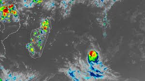
While the Atlantic hurricane season is still months away, the world’s oceans are already witnessing the raw power of tropical cyclones. Recently, Tropical Cyclone Horacio rapidly intensified, becoming the first Category 5 tropical cyclone of 2026 on February 23rd. Meteorologist Jeff Masters, writing for Yale Climate Connections, reported peak sustained winds of 160 mph over the warm waters of the remote South Indian Ocean.
Horacio’s Trajectory and Current Status
Fortunately, forecasters at the Joint Typhoon Warning Center indicate that Horacio has reached its peak intensity and is now expected to gradually weaken as it moves southward over cooler waters. Crucially, the storm poses no immediate threat to land, impacting only marine interests. However, Horacio serves as a potent reminder that the 2026 Atlantic hurricane season is rapidly approaching.
The Role of El Niño in the 2026 Hurricane Season
What can we expect from the upcoming season? Experts believe an evolving El Niño pattern will significantly influence both the Atlantic and Pacific hurricane seasons. El Niño, characterized by a warming of the tropical Pacific Ocean, typically suppresses hurricane activity in the Atlantic basin, particularly in the Caribbean and Gulf of Mexico. As Andy Hazelton, an associate scientist with the University of Miami, explained to USA TODAY, this effect is common.
Conversely, El Niño often leads to more active hurricane seasons in the eastern and central Pacific Oceans. Hazelton further noted that the specific location of the warmest water within the Pacific – whether in the East or Central Pacific – will determine which basin experiences the most above-normal activity.
Historical Context and Storm Classification
Horacio is the first Category 5 cyclone in the Southern Hemisphere since Cyclone Errol achieved that status off the coast of northwestern Australia in April 2025. Globally, the average number of Category 5 storms per year between 1990 and 2025 was 5.3. In 2025, five storms reached Category 5 intensity: Hurricanes Melissa, Erin, and Humberto in the Atlantic; Typhoon Ragasa in the Northwest Pacific; and Cyclone Errol in the South Indian Ocean.
Interestingly, despite El Niño’s tendency to reduce Atlantic hurricanes, the last three Category 5 hurricanes to strike the United States – Camille (1969), Andrew (1992), and Michael (2018) – all occurred during periods when the ocean was transitioning to weak El Niño conditions.
Understanding Tropical Cyclone Terminology
It’s important to remember that hurricanes, typhoons, and cyclones are all fundamentally the same type of weather phenomenon – tropical cyclones. The name used depends on the ocean basin where the storm originates. The National Oceanic and Atmospheric Administration (NOAA) explains that:
- Hurricanes form in the Atlantic basin and the eastern and central Pacific basins.
- Typhoons develop in the western Pacific.
- Cyclones (also known as tropical cyclones) form in the Indian Ocean and the South Pacific.
The South Indian Ocean cyclone season typically runs from November to April, mirroring the cyclone seasons near Australia, although cyclones can technically form year-round. The period from November to April offers the most favorable conditions – warm ocean water and reduced wind shear.
Doyle Rice is a national correspondent for USA TODAY, specializing in weather and climate reporting.


