
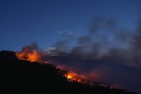
Navigating the 2026 B.C. Wildfire Season: Your Guide to the Live Fire Map
As British Columbia enters the 2026 wildfire season, staying informed is not just a convenience—it’s a necessity for safety. While officials have noted a relatively cooler start to the season, the unpredictable nature of wildfires means that residents and travelers must remain vigilant.
To help citizens navigate these risks, an interactive live fire map has been deployed, providing real-time data on fire locations, perimeters, and critical evacuation statuses. Whether you are a local resident or visiting the beautiful landscapes of B.C., knowing how to read this map can save lives.
How to Read the Interactive Fire Map
The fire map uses a specific color-coded system to communicate the severity and status of wildfires. Understanding these symbols allows you to make quick, informed decisions about your safety and evacuation plans.
Evacuation Status & Alerts
- Magenta Triangle: Indicates an active Evacuation Order. Leave the area immediately.
- Yellow Triangle: Indicates an Evacuation Alert. Be prepared to leave on short notice.
- Gray Triangle: Represents an outdated evacuation alert or order.
- Magenta Triangle with Flames: This marks a Wildfire of Note, highlighting fires that are particularly significant or dangerous.
Fire Control Status
The circles on the map tell you how well the fire is being managed by crews on the ground:
- Magenta Circle: Out of control.
- Yellow Circle: Being held (the fire is not expanding, but not yet contained).
- Green Circle: Under control.
Understanding Fire Perimeters
As you zoom into the map, you will notice red outlines. These are the wildfire perimeters. These outlines are crucial because they show the actual geographic boundary of the fire. In many cases, multiple fires merge into large clusters spanning thousands of hectares, and these perimeters help emergency services and the public understand the true scale of the blaze.
Stay Prepared and Informed
Wildfires can move with incredible speed. We strongly recommend that all residents check the map daily and follow official government channels for the most accurate updates. For more comprehensive emergency planning, visit the Emergency Management BC portal.
Stay safe, stay alert, and ensure your emergency kit is ready for the season.



