
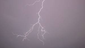
Weather Tomorrow: Thunderstorms and a Refreshing Cool-Down for Northeast Wisconsin
If you’ve been feeling the heat lately, there is some relief on the horizon. After a stretch of intense humidity and soaring temperatures, Northeast Wisconsin is bracing for a shift in the atmosphere. From dense fog to scattered storms, the upcoming days will be dynamic, requiring a quick check of the weather tomorrow before you head out the door.
Current Conditions: Heat and Humidity
To kick off September, the region is experiencing a typical late-summer surge. With highs reaching near 90°F and humidity levels making it feel even warmer, the air remains heavy. Additionally, those in areas north of Green Bay have been dealing with dense fog, prompting early morning advisories to ensure road safety.
What to Expect: The Forecast for Tonight and Tomorrow
The weather pattern is about to change. As we move into the evening, the humidity will give way to instability. Here is what you need to know:
- Tonight: Expect mostly cloudy skies. The primary concern will be scattered thunderstorms, which are most likely to develop after midnight.
- Weather Tomorrow (Wednesday): The day will start with morning thunderstorms. However, as the storms clear, a mix of sun and clouds will move in. Most importantly, temperatures will drop significantly, with a refreshing high of 81°F.
Looking Ahead: Thursday and Friday
The trend of morning instability is expected to continue through the end of the work week. If you are planning outdoor activities, keep an eye on the radar:
- Thursday: More scattered thunderstorms are forecasted for the morning hours, followed by mostly cloudy skies and a high of 79°F.
- Friday: The pattern repeats with another chance of morning storms and a high reaching 80°F under cloudy skies.
Staying Safe During Storms
With several days of forecasted thunderstorms, it is essential to stay informed. Sudden lightning and heavy rain can impact visibility and travel. For real-time updates and severe weather alerts, we recommend monitoring the National Weather Service to ensure you and your family stay safe.
Stay tuned for more local updates as we track these shifting weather patterns across the region!



