
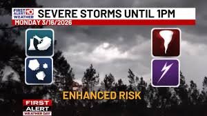
Tallahassee Weather Update: First Alert Weather Day Extended
The First Alert Weather Day for Tallahassee and surrounding areas has been extended through 1 p.m. on Monday, March 16th. Residents should prepare for a dynamic weather system bringing the potential for severe thunderstorms, damaging winds, and even tornadoes.
Timeline of the Storm
Isolated thunderstorms are already beginning to develop as of 4 a.m., primarily in the far western counties. However, the most significant threat of widespread severe weather will arrive around 6 a.m. as a strong line of storms moves into the region. By this time, both the main line and discrete thunderstorm activity ahead of it will be in full swing.
- 6 a.m. – 7 a.m.: Western counties of Southwest Georgia (SGA) will experience the brunt of the storm, with a heightened risk of tornadoes, winds gusting up to 70 mph, and hail larger than an inch in diameter.
- 7 a.m. onwards: Storms will spread eastward, impacting Albany and surrounding areas.
The severe weather threat is expected to linger until early afternoon, around 1 p.m. While a few showers may persist afterward, they will not pose a severe risk.
Dramatic Temperature Drop
Prepare for a significant temperature swing! We’ll start the day in the 60s, but temperatures are forecast to plummet into the 40s by the afternoon. This rapid cooling adds another layer of concern, especially for those unprepared for the change.
Stay Informed & Safe
It’s crucial to stay informed and have multiple ways to receive weather alerts:
- WALB Weather: Follow WALB Weather on social media (Facebook and X/Twitter) for real-time updates.
- NWS Tallahassee: The National Weather Service Tallahassee office (https://www.weather.gov/tal/) is an excellent source of official information.
- WALB News 10 App: Download and update the WALB News 10 app and enable push notifications. Download the WALB News 10 App
- Weather Radio: A NOAA Weather Radio is a reliable source of alerts.
- Live TV Broadcasts: Tune into WALB News 10 for continuous coverage.
You can also stream WALB News 10 on any device by downloading the free streaming app on Android, Roku, Fire TV, and Apple TV. Search “WALB News 10” to find it.
Looking Ahead: Freeze Warnings & Warming Trend
A late-season frost/freeze is forecast for Monday and Tuesday nights, with freezing to sub-freezing wind chills. A Freeze Warning is in effect beginning late tonight in Southwest Georgia. Highs will reach the 50s on Tuesday with sunshine. Another widespread freeze with patchy frost is expected Wednesday morning, with temperatures in the 20s and 30s. This freeze could significantly impact agriculture due to the early planting and blooming season.
Fortunately, temperatures will begin to moderate late in the week, with dry conditions prevailing through the weekend. We can expect highs in the 70s by mid-week and a return to the 80s by the weekend.
Stay tuned to WALB News 10 Weather for the latest forecasts and updates. View the First Alert Radar and find all the latest weather headlines here.
Copyright 2026 WALB. All rights reserved.


