
Cincinnati Weather Update: A Quick-Moving System Arrives
Cincinnati residents should prepare for a brief period of mixed precipitation early Thursday morning. A weak weather system is moving in overnight, bringing the possibility of both snow and rain. While the system is fast-moving, the timing could impact the morning commute.
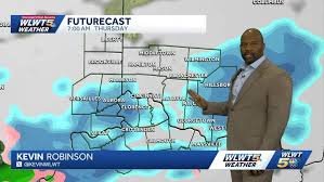
Thursday Morning Forecast: Snow or Rain?
The biggest question mark revolves around the amount and type of precipitation. Currently, forecasts suggest less than one inch of snow accumulation. The snow chance begins around 2 a.m. and is expected to clear out by 7 a.m. Temperatures will be hovering just below freezing during this time, potentially minimizing road impacts. However, Wednesday’s warmer temperatures raise the possibility of the snow melting on contact with the pavement.
Areas south of the Ohio River have a higher probability of experiencing rain showers rather than snow.
Weekend Outlook: Sunshine and Warmer Temperatures
The good news doesn’t end there! Following Thursday’s system, Cincinnati can look forward to several days of sunshine. Temperatures are expected to climb, with highs potentially reaching near 60°F on both Friday and Saturday. This will provide a welcome change after the chilly start to the week.
WLWT Weather: Cincinnati’s Most Accurate Forecast
WLWT Weather consistently delivers the most accurate forecasts in Cincinnati, as confirmed by WeatheRate, a national research company. Led by Chief Meteorologist Kevin Robinson, the WLWT Weather team is the only local station to earn the “Most Accurate” rating annually.
Stay Updated:
Visit the WLWT weather page for the latest updates and subscribe to WLWT’s YouTube channel.
Connect with WLWT:
Source: WLWT Cincinnati


