Polar Vortex Collapse Forecast: A Chilling Outlook for April 2026
The stratospheric Polar Vortex is entering its final seasonal phase, undergoing a Final Warming event that signals the end of its winter dominance. However, as this high-altitude circulation dissipates, it releases the lower-level Polar Vortex core, poised to deliver another round of impactful weather across North America and Europe in April 2026. Current analysis confirms a residual Polar Vortex core remains active in the lower atmosphere, centered over North America and eastern Canada. This fragment is expected to bring late-season snowfall and below-normal temperatures to parts of the United States.
Understanding the Polar Vortex
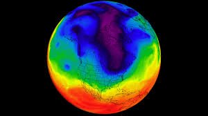
We often discuss the Polar Vortex, and while we’ve covered the theory extensively during winter, a refresher is helpful, especially as dynamics shift in spring. Simply put, the Polar Vortex is a large-scale winter circulation over the northern (and southern) hemispheres. Imagine it as a spinning wall rising from the surface into the stratosphere (over 50km/30 miles high), trapping cold polar air.
The Polar Vortex consists of two layers: the stratosphere (higher altitudes) and the troposphere (lower altitudes). These layers are interconnected but play distinct roles. This distinction is crucial in spring, as the upper (stratospheric) part dissolves, and the lower part becomes dominant.

Disruptions to the Polar Vortex often stem from a rise in stratospheric pressure and temperature – a Stratospheric Warming (SSW) event – or other dynamics originating in the lower levels. You can visualize the Polar Vortex structure and its disruption in this video demonstrating a January disruption from a Stratospheric Warming event.
The April 2026 Outlook
By April, the stratospheric Polar Vortex can no longer withstand the seasonal warming and eventually dissolves. This removes the atmospheric barrier that confines cold air, allowing lower-level Polar Vortex cores to fragment and wander. This transition can rapidly shift the atmosphere from a stable late-winter pattern to a volatile spring setup, where cold-core fragments can move freely across mid-latitudes without stratospheric constraints.
We monitor the stratospheric Polar Vortex by observing wind speeds around the polar circle. Strong positive (westerly) winds indicate stability, while weak or negative (easterly) winds signal a reversal or dissolution. NASA’s analysis for the 2025/2026 season (see NASA’s Polar Vortex page) shows a weak Polar Vortex in the stratosphere, currently running near 0, indicating its dissolution.
This shift away from stratospheric influence allows for the propagation of downward waves, as illustrated by hebweather.net, impacting lower-level weather patterns. The 3D forecast indicates an active Polar Vortex core in the lower stratosphere and troposphere, persisting longer than its upper counterpart.
Impacts on North America and Europe
The current pattern supports a westerly flow across the United States, with a continued risk of colder air intrusions from the north. Low-pressure systems moving around the Polar Vortex core area will contribute to this. Europe, meanwhile, is expected to experience a milder/warmer flow.
Early April forecasts show a low-pressure core over eastern Canada and the North Atlantic, part of the remaining lower stratosphere Polar Vortex core. This suggests a potential colder airflow period over the northern and eastern United States, with below-normal temperatures. Simultaneously, a warmer westerly flow is expected in Europe.
Temperature anomaly forecasts for the first week of April confirm below-normal temperatures over eastern Canada and the northern United States. Precipitation forecasts indicate increased rainfall over the upper Midwest, central, and south-central United States, with a significant portion falling as snow. Europe is expected to remain relatively dry in central areas, with rainfall in the southeast and northwest.
Looking ahead to mid-April, the pressure forecast shows a persistent low-pressure Polar Vortex core over northern Canada and a high-pressure zone over far northern Europe. This pattern supports a cold front scenario over the northern United States and potentially brings lower temperatures to Europe. There’s even a possibility of an Omega Blocking pattern developing, characterized by a high-pressure zone flanked by two low-pressure areas, potentially leading to warmer weather under the high and unstable conditions in the lows.
Looking Further Ahead
As we move into the second half of April, the lower Polar Vortex core is expected to weaken further. However, a high-pressure blocking pattern may establish, influencing weather patterns. The ECMWF extended-range forecast suggests a dominant high-pressure system over the United States, with a low-pressure core retreating towards the polar regions.
This article is based on the latest model data, and we will continue to provide weekly updates on this evolving situation. Stay tuned for further developments!
Source: Severe Weather Europe