
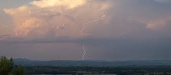
Tomorrow’s Weather: Severe Storm Warnings and Supercell Alerts for France
If you are planning a trip or currently residing in France, you need to stay alert. The meteorological outlook for the coming days indicates a period of high instability, with several successive storm episodes expected to sweep across the region. From violent supercells to extreme heat, the weather is taking a volatile turn.
Detailed Weather Forecast: What to Expect
The atmospheric conditions are currently primed for deep convection, which creates the perfect environment for the formation of severe weather patterns. Here is the breakdown of the expected events:
Wednesday, August 26: Severe Instability in the West
A significant deterioration in weather is expected during the afternoon and evening, specifically across the western part of the country. Residents and travelers should prepare for:
- n
- Strong localized thunderstorms with sustained electrical activity.
- Hailstones and powerful wind gusts that could cause local damage.
- Supercell formation: The current ingredients are ideal for these violent, rotating storms.
While the west faces storms, the East and Southwest will experience rising temperatures. In areas south of the Garonne, temperatures are expected to exceed 35°C, and a short heatwave peak is anticipated in Corsica.
Thursday, August 27: Storms Spread Across the Hexagon
As the initial storms move toward the Northeast early in the morning, the instability will not disappear. Instead, it will expand. Two new active storm axes are expected to develop:
- The Central Axis: Forming west of the Massif Central and extending toward Lorraine.
- The Western Axis: Stretching from Vendée up to the Hauts-de-France region.
Additionally, the possibility of tornadic phenomena remains a concern for both Wednesday and Thursday.
Friday, August 28: Movement Toward the East
By Friday morning, the rain and storm axis will shift further east. The Rhône Valley and the Northeast will be the primary targets, with marked activity continuing through midday in the Alps and Jura mountains.
Understanding the Danger: Supercells and Hail
To better prepare, it is important to understand what these meteorological phenomena actually are. According to the National Oceanic and Atmospheric Administration (NOAA), severe weather requires specific atmospheric triggers.
What is a Supercell?
Unlike a standard thunderstorm, a supercell is an isolated but highly violent storm. It features a rotating updraft called a mesocyclone, making it far more destructive and capable of producing large hail and tornadoes.
The Danger of Hail:
Hail consists of ice particles larger than 5mm. These typically form within powerful cumulonimbus clouds where strong vertical currents toss ice pellets upward until they become heavy enough to fall, often causing significant damage to vehicles and crops.
Safety Guide: How to Protect Yourself
When a meteorological vigilance alert is issued, taking immediate action can save lives. Follow these essential safety tips:
- Seek Solid Shelter: Always stay inside a reinforced building. Avoid sheds, tents, or cars during a storm.
- Avoid Hazards: Stay away from tall trees, electrical poles, and bodies of water, as these can attract lightning.
- Stay Informed: Keep a close eye on official weather updates and activate mobile notifications for real-time alerts.
- Unplug Electronics: To prevent damage from power surges caused by lightning, unplug sensitive electronic devices.
Stay safe and keep monitoring tomorrow’s weather to ensure your security and the security of your loved ones.



