The Strange Silence of the Tropics: Is the 2026 Atlantic Hurricane Season Breaking Records?
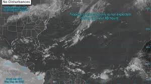
A Rare Quiet in the Atlantic: What is Happening in the Tropics?
For those keeping a close eye on the tropics, the 2026 Atlantic hurricane season has taken an unexpected turn. While we have typically entered the most volatile window of the year, the Atlantic basin remains eerily quiet. With the climatological peak of the season occurring around September 10, the lack of major storm activity is sparking conversations among meteorologists and weather enthusiasts alike.
Currently, former Hurricane Lowell has weakened as it drifts away from the Hawaiian Islands, and the National Hurricane Center (NHC) reports no significant tropical cyclone activity expected over the next seven days. But this silence might be more than just a lull—it could be a historic anomaly.
A Potential Satellite-Era Record
We are approaching a critical date. According to experts from AccuWeather, if no hurricane forms by Friday, September 11, the 2026 season will set a new record. It would mark the latest point in the satellite era (which began in the 1960s) to go without a single Atlantic hurricane.
To put this into perspective, the latest dates for a first hurricane previously occurred in 2002 and 2013, both on September 11. A completely hurricane-free season is even rarer; the last time the Atlantic saw zero hurricanes was way back in 1914.
Why the Tropics Are Staying Calm: The El Niño Effect
You might wonder why the atmosphere isn’t producing the usual chaos. The primary culprit is El Niño. This natural warming of the central and eastern tropical Pacific Ocean creates a ripple effect that reaches the Atlantic. Specifically, El Niño triggers two major inhibitors:
- n
- Increased Wind Shear: Strong upper-level winds essentially “tear apart” developing storms before they can organize.
- Dry, Dusty Air: A surge of dry air makes it incredibly difficult for thunderstorms to sustain the moisture needed to fuel a tropical cyclone.
Meteorologists from Colorado State University have noted that wind shear in the western tropical Atlantic and Caribbean is currently shattering previous records, leaving very little room for storm intensification.
Understanding Tropical Waves: The Seeds of Storms
Despite the current calm, forecasters are still monitoring several tropical waves. These are essentially clusters of showers and thunderstorms that migrate across the ocean. According to Alex DaSilva, a lead hurricane expert, about 60 of these waves cross the Atlantic annually.
While only about 10% to 15% of these waves develop into tropical systems, they are crucial because they contribute to roughly 80% of all major hurricanes. Currently, the National Hurricane Center is tracking four such waves, with a slight possibility of development off the southeastern coast of the United States mid-month.
Staying Prepared in an Unpredictable Season
Even in a “below-normal” year, the tropics can be unpredictable. The Atlantic hurricane season officially runs from June 1 through November 30, and the majority of activity is concentrated between mid-August and mid-October. Whether we are heading toward a record-breaking quiet year or a late-season surge, staying informed is key.
For the most accurate and up-to-date tracking, we recommend following official updates from NOAA and the NHC to ensure your home and family remain protected.
📰 You May Also Like