
Severe Thunderstorm Warning: Tornado Watch Hits Mid-Atlantic Region
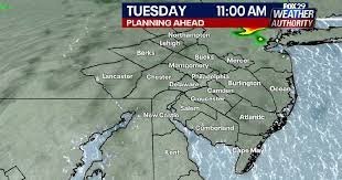
The Mid-Atlantic region is bracing for a volatile weather pattern this Tuesday, as a powerful storm system sweeps through the area. A severe thunderstorm warning and tornado watches have been issued, putting millions of residents on high alert, particularly in the Philadelphia metropolitan area and surrounding states.
What You Need to Know: High Risks for PA, NJ, and DE
Meteorologists are tracking a dangerous system moving across Pennsylvania, New Jersey, and Delaware. This weather event is not just bringing heavy rainfall but also the terrifying possibility of tornadoes. Local authorities are urging residents to stay vigilant as the system progresses through Tuesday night.
Key threats identified in the current weather alerts include:
- n
- Tornado Watches: Active across portions of the tri-state area, meaning conditions are favorable for tornado development.
- Dangerous Wind Gusts: Winds are expected to reach speeds of up to 70 mph, capable of causing power outages and structural damage.
- Flash Flooding: Intense rainfall may lead to rapid flooding in low-lying urban and rural areas.
How to Stay Safe During a Severe Weather Event
When a severe thunderstorm warning is in effect, immediate action can save lives. If you are in the Philly area or the broader Mid-Atlantic region, follow these essential safety guidelines:
- Seek Shelter: Move to an interior room on the lowest floor of a sturdy building. Avoid windows.
- Stay Informed: Keep a battery-powered weather radio nearby or enable emergency alerts on your smartphone.
- Avoid Travel: With 70 mph wind gusts and heavy rain, visibility will be low and roads may be hazardous.
- Secure Outdoor Items: Bring in patio furniture or trash cans that could become dangerous projectiles in high winds.
Stay Updated with Official Sources
Weather conditions can change in an instant. For real-time radar updates and official emergency notifications, we highly recommend monitoring the National Weather Service (NWS), the gold standard for meteorological alerts in the United States.
Stay tuned to local news outlets for travel advisories and emergency shelters in your specific county. Your safety is the priority—don’t wait until the storm hits to create your emergency plan.



