
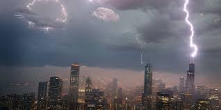
Severe Storms Surge Across US: How to Use Weather Radar to Stay Safe from Derechos and Tornadoes
The United States is currently facing a volatile weather pattern, with severe threats escalating across the Midwest and extending toward the East Coast. From destructive winds to the looming threat of a derecho, staying informed is not just a convenience—it’s a necessity. By monitoring a real-time weather radar, residents can get the critical minutes needed to seek shelter and protect their families.
The Midwest Under Siege: Monday’s Storm Surge
Monday morning kicked off with high intensity as severe storms barreled through Wisconsin, impacting areas like Green Bay and Milwaukee during the morning rush hour. A confirmed tornado already tore through the Appleton area, signaling the dangerous nature of this system.
Meteorologists are tracking a Mesoscale Convective System (MCS)—a massive, organized cluster of storms that functions as a single, powerful weather engine. This system is expected to move through:
- n
- Chicago and Northern Illinois: Impacting midday with high wind risks.
- Indiana: Pushing south throughout the afternoon.
- Western Kentucky: Reaching the region by evening.
Experts warn that winds could exceed 75 mph, creating a high risk for widespread power outages and structural damage.
What is a Derecho? Why You Should Be Concerned
As the storm line intensifies, the term “derecho” has surfaced in forecast models. But what exactly is it? A derecho is a widespread, long-lived wind storm associated with a band of rapidly moving showers or thunderstorms. Unlike a typical storm, a derecho delivers a continuous path of destruction, often knocking down thousands of trees and crippling power grids.
Given the current heat dome building to the west, the atmospheric energy is peak, making the development of a derecho highly probable. This is where keeping a National Weather Service (NWS) weather radar open becomes vital for real-time tracking.
The Shift to the East Coast and I-95 Corridor
The volatility doesn’t stop in the Midwest. By Tuesday, the storm threat shifts toward the Mid-Atlantic and the Carolinas. A cold front moving through Pennsylvania, West Virginia, and eastern Kentucky is expected to trigger new activity.
Key areas to watch include:
- n
- Maryland and Virginia: Potential for supercells bringing large hail and damaging gusts.
- North Carolina: Risk of isolated tornadoes and severe wind.
- New England & I-95 Corridor: An increased threat of flash flooding that could disrupt travel and cause urban flooding.
The Role of the Heat Dome
This extreme “weather whiplash” is fueled by a massive heat dome, leaving over 85 million Americans across 20 states baking in triple-digit temperatures. This intense heat provides the fuel (moisture and instability) that allows these storms to become so organized and violent.
Stay Safe: Pro Tips for Storm Tracking
When severe weather is in your area, don’t rely on a single source. To maximize your safety:
- Use a High-Resolution Weather Radar: Look for reflectivity and velocity data to spot rotating cells (tornado potential).
- Enable Emergency Alerts: Ensure your smartphone’s wireless emergency alerts (WEA) are turned on.
- Have a Plan: Identify the safest room in your home and keep a battery-powered radio handy.
Stay tuned to local updates and keep your weather radar active to navigate this multiday event safely.



