Polar Vortex Weather Forecast: An Unprecedented Arctic Blast Looms for Canada and the Northern Hemisphere
A dramatic transformation is underway high above the North Pole, in a rarely observed atmospheric layer. Over the coming weeks, significant shifts in the stratosphere are poised to reshape global weather patterns, setting the stage for an unusually cold and snowy December across vast swathes of the Northern Hemisphere, including much of Canada.
This potential swing from current record-high temperatures in some regions to intense cold could begin as early as late November, marking what scientists describe as one of the earliest significant polar vortex disruptions recorded in the satellite era.
Understanding the Polar Vortex and Its Impact
Imagine the stratospheric polar vortex as an invisible, high-altitude wall of wind, diligently containing the ultra-cold Arctic air over the North Pole. When this protective wall weakens or becomes unstable, that frigid air can “spill” southward, bringing extreme cold to populated areas like Canada, the Lower 48 states, Europe, and Asia.
Currently, the stratosphere – the atmospheric layer situated above where most daily weather occurs – is experiencing a rapid and profound warming event. This phenomenon is known as a Sudden Stratospheric Warming (SSW) event.
The Science Behind the Impending Chill
Paradoxically, this sudden warming in the far upper atmosphere is a precursor to anything but warmth on the ground. As meteorologist Amy H. Butler of the National Oceanic and Atmospheric Administration (NOAA) explains, this warming causes the polar vortex winds to weaken, and they could even reverse direction. Scientists are intensely studying why these SSW events occur, especially given their direct link to some of the most intense polar vortex weather forecast cold-air outbreaks observed.
Judah Cohen, a research scientist at MIT’s Department of Earth, Atmospheric and Planetary Sciences, notes an unusual aspect of the current event: its timing. Sudden Stratospheric Warming events of this magnitude are almost unprecedented in November. This early disruption suggests a potentially prolonged period of instability for the vortex.
Over the next two weeks, these atmospheric shifts are expected to propagate downwards, with North America, Europe, and Asia beginning to feel the effects as the polar vortex weakens and veers off course, much like a slowing, wobbly spinning top.
What This Means for Canada and Beyond
While the exact intensity and precise location of the cold blast remain challenging to predict, experts are closely monitoring for significantly colder-than-normal conditions across the mid-latitudes – where the majority of the world’s population resides – over the coming month. Once the polar vortex is disrupted, it can take a month or more for it to fully recover, as highlighted by Andrea Lopez Lang, a meteorologist at the University of Wisconsin-Madison.
Lopez Lang points out that historical polar vortex events occurring early in winter have often been followed by colder and snowier Decembers, particularly in regions of the U.S. and potentially extending into Canada. Such events tend to generate a ridge of warm, high pressure over Alaska, which, in turn, creates a dip or trough in the jet stream further east. This trough can usher in the much colder, snowier conditions over central and eastern parts of North America.
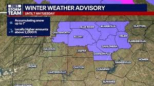
For Canadians, this forecast could mean preparing for an early arrival of severe winter weather, including significant snowfall and plunging temperatures. Keeping an eye on localized winter forecast Canada updates will be crucial.
Challenges in Forecasting and Data Collection
Accurate long-range weather predictions, especially concerning these complex atmospheric events, are invaluable for decision-making across various sectors. Both Butler and Lopez Lang emphasize that precise forecasts for polar vortex events greatly enhance the reliability of 7- to 10-day forecasts.
Despite the critical impact of the stratospheric polar vortex on our daily weather, scientists are facing increasing challenges in observing this vital atmospheric layer. Lopez Lang underscores the indispensable role of satellite data in tracking the stratosphere and predicting SSW events. However, she notes that some crucial data is becoming less available as satellites age and funding decisions impact NOAA’s ability to maintain and enhance these measurements.
“The only way that we really observe these phenomena is via satellite data,” Lopez Lang states, highlighting a growing concern for future extreme cold weather prediction capabilities.
As we head into the colder months, understanding the intricate “invisible puppet strings” connecting the stratospheric polar vortex to our weather – through atmospheric dynamics and thermodynamics – becomes more vital than ever. Canadians and residents across the Northern Hemisphere should remain vigilant and prepared for a potentially unusual and intense winter ahead.


