
Phoenix Weather Alert: West Valley Grapples with Severe Storms, Flash Floods, and Power Disruptions
PHOENIX, AZ – Residents across Phoenix’s West Valley faced a tumultuous Wednesday as a powerful string of thunderstorms swept through the region, unleashing heavy rain, significant hail, and widespread disruption. The volatile Phoenix weather event triggered flash flood warnings, grounded flights, and left thousands without power, painting a vivid picture of nature’s immediate impact on daily life.
West Valley Slammed: Rain, Hail, and Rising Waters
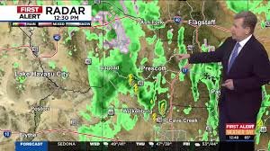
The storm system, originating from the southwest, tracked across critical areas, hitting Avondale and Tolleson before moving into Glendale and Peoria. Eyewitness accounts and social media feeds quickly filled with dramatic footage showcasing streets transformed into temporary rivers and landscapes blanketed in sheets of ice-like hail. The intensity of the downpour led the National Weather Service to issue a Flash Flood Warning for parts of the West Valley, urging residents to exercise extreme caution as roads became impassable.
Stay updated with official alerts: National Weather Service
Sky Harbor Impact: Flight Delays and Ground Stops
The severe Phoenix weather didn’t just affect ground transportation; it rippled through air travel as well. Phoenix Sky Harbor International Airport experienced significant operational challenges. The Federal Aviation Administration (FAA) briefly issued a ground stop for incoming flights, though it was lifted by early evening. However, the ripple effect caused considerable delays, with departing flights averaging 15-minute hold times into the evening hours.
For real-time flight information: FlightAware
Thousands Lose Power Amidst the Storm
As the storms raged, thousands of residents found themselves plunged into darkness. At its peak, over 5,500 SRP customers, primarily in Glendale and parts of west Phoenix, reported power outages. While APS customers experienced fewer disruptions, the widespread power loss underscored the storm’s intensity and its capacity to interrupt essential services.
Lingering Flood Threat: Saturated Ground and Future Systems
The danger isn’t over. With the ground already saturated from recent rainfall, any additional precipitation significantly increases the risk of further flooding. A Flood Watch remains in effect for northern Maricopa County, encompassing areas such as Deer Valley, Rio Verde, Surprise, and Vistancia. The watch also extends to parts of Yavapai County, including cities like Prescott, Cottonwood, and Camp Verde, where heavy thunderstorms could again lead to hazardous conditions.
The Phoenix Weather Forecast: A Glimpse Ahead
Looking forward, temperatures in the Valley are expected to remain in the mid-60s for the next few days, offering a slight reprieve from the usual desert heat. Drier conditions and highs returning to the 70s are anticipated by next week.
- Thursday Morning: Lingering showers across the Valley as the system pushes east.
- Thursday Afternoon: Expected to be mostly dry in the Valley.
- High Country: Snow levels will drop to around 6,500 feet through Thursday, with Flagstaff potentially receiving another 1-2 inches of snow. Eastern Arizona, particularly from the Rim to the White Mountains, could see heavier accumulations.
- Next System: Another Pacific weather system is forecast to move into Arizona Thursday night, increasing rain chances in western Arizona by early Friday morning.
- Weekend Outlook: Rain chances hover around 30% for the Valley on Saturday and Sunday, with rainfall amounts still uncertain.
As Arizona navigates this active weather pattern, staying informed and prepared is paramount. Keep an eye on local advisories for the latest updates on Arizona storms and the evolving Phoenix forecast.


