Northeast Braces for Potential Nor’easter: Latest Snow Weather Forecast and Cold Blast Alerts
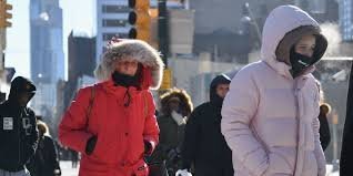
Northeast Braces for Potential Nor’easter: Latest Snow Weather Forecast and Cold Blast Alerts
The eastern United States is on high alert as a significant weather shift takes shape. According to the latest snow weather forecast, a potential nor’easter could slam the Northeast and New England before the end of the week, ushering in a brutal late-season cold blast that will affect millions of residents.
While meteorological uncertainty remains, the stage is set for a dramatic clash of air masses. As warmer weather builds across the West, frigid Canadian air is punching south, creating the perfect conditions for a strengthening low-pressure system.
The Science Behind the Storm: Polar Vortex and Jet Streams
This isn’t your typical El Niño pattern. Experts indicate that a dip in the polar jet stream, combined with an unusually early disruption of the stratospheric polar vortex, is driving this volatility. This atmospheric instability allows cold air to plunge deep into the eastern U.S., fueling a storm system that could originate anywhere from the Great Lakes to the Ohio Valley.
For more detailed information on how these patterns work, you can explore the National Oceanic and Atmospheric Administration (NOAA) resources.
Three Potential Scenarios: What to Expect
Forecast models are currently weighing three different tracks for the storm, each with varying impacts on the I-95 corridor and inland regions:
- n
- The Inland Track: If the system moves across the Ohio Valley and Great Lakes before shifting offshore, the immediate coast may remain dry, while higher elevations and inland areas see accumulating snow.
- The Coastal Track: If the nor’easter hugs the Eastern Seaboard, we can expect heavy rain, powerful wind gusts, and limited snow confined mostly to the mountains due to a lack of deep cold air.
- The Offshore Track: The “wildcard” scenario. If the storm tracks too far east into the Atlantic, precipitation will be pushed away from the coast, significantly reducing the impact for most residents.
Who is Most at Risk for Snow?
Regardless of the exact track, the snow weather forecast remains most concerning for the higher elevations of New England and the interior Northeast. Areas such as Maine, Vermont, New Hampshire, and upstate New York, as well as parts of the Appalachians, have the highest probability of seeing significant snow accumulation.
For those along the I-95 corridor, any snow is likely to be a mix or a brief transition, as surface temperatures and rain will make it difficult for snow to stick.
The Aftermath: A Massive Temperature Plummet
The storm is only the beginning. Once the system pulls away toward Canada by Saturday, a late-autumn air mass will settle over the region. The results will be staggering:
- Widespread Cold: Over 110 million people in the Northeast and surrounding areas could see afternoon highs struggle to reach the 30s.
- Freezing Lows: Lows are expected to plummet into the 20s across the Great Lakes and Ohio Valley.
- Southern Reach: This cold front could potentially reach as far south as the Gulf Coast and Florida by Sunday.
To stay safe during sudden temperature drops, check the National Weather Service for real-time freeze alerts and safety tips.
Summary: West Warms Up, East Freezes Over
While the East battles a potential winter resurgence, the West will experience the opposite. Cities from California to the desert Southwest are expected to see temperatures 10-20 degrees above average, highlighting the extreme contrast currently gripping the nation.
Stay tuned to local weather updates and keep your winter gear ready as this system continues to develop!
📰 You May Also Like