
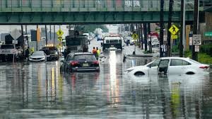
North Jersey Weather Alert: Heavy Rain, Flash Floods, and Severe Storm Risks
Residents of North Jersey should prepare for a volatile weather pattern as a complex system of warm and cold fronts moves through the region. From August 2nd through August 3rd, the area is expected to face repeated showers and thunderstorms, bringing significant rainfall and the risk of flash flooding.
Primary Threat: Excessive Rainfall and Flash Flooding
According to Brian Ciemnecki, a meteorologist with the National Weather Service (NWS) in New York, the most pressing concern for the region is the potential for flash flooding. While the general forecast predicts about three-quarters of an inch of rain, localized heavy downpours could lead to much higher totals.
The Weather Prediction Center has issued a Level 2 risk of excessive rainfall for August 3rd. This indicates that forecasters are closely monitoring the area for scattered flash flooding, which can occur rapidly in flood-prone neighborhoods.
Wind Gusts and Tornado Warnings: What You Need to Know
While the primary threat is water-related, the severity of these thunderstorms cannot be ignored. Although widespread tornado warnings are not expected to be the main story of this event, isolated severe storms can produce dangerous conditions.
- n
- Wind Gusts: Strong storms could generate wind gusts of up to 60 miles per hour, capable of causing property damage.
- Atmospheric Instability: The interaction between the warm and cold fronts makes the weather hard to predict, meaning conditions can change in minutes.
- Stay Vigilant: Residents are encouraged to keep their weather alerts active to receive immediate notifications regarding any sudden tornado warnings or severe thunderstorm watches.
Weather Timeline: When to Stay Indoors
To help you plan your week, here is the expected progression of the weather system:
| Date | Expected Conditions | Risk Level |
|---|---|---|
| August 2 | Rain chances increase in the afternoon; thunderstorms likely at night. | Moderate |
| August 3 | Heavy rain bands and thunderstorms throughout the day. | High (Flash Flood Risk) |
| August 4 | Rain slows down; drier conditions expected. | Low |
Safety Tips for North Jersey Residents
Given the unpredictability of this system, taking a few precautions can make a big difference. If you live in an area prone to flooding or are concerned about severe weather, follow these guidelines:
- Check Conditions: Always check the latest NWS updates before heading out.
- Turn Around, Don’t Drown: Never drive through flooded roadways; most flash flood fatalities occur in vehicles.
- Have a Plan: Know where your safe room is in case of severe wind or a sudden tornado warning.
- Stay Informed: Use a NOAA Weather Radio or a reliable weather app for real-time alerts.
Looking ahead, temperatures will remain steady in the low to mid-80s, with overnight lows in the upper 60s to lower 70s due to persistent cloud cover. While rain is expected to pause on August 4th, prepare for another increase in precipitation by mid-week.



