
The Invisible Shield: What Happens When NOAA Hurricane Tracking Satellites Go Offline?
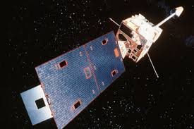
Imagine the meteorologists tasked with protecting millions of people from devastating storms suddenly losing their sight. This isn’t a plot from a disaster movie; it’s a scenario that briefly unfolded when a critical piece of space technology, the GOES-19 satellite (also known as GOES East), experienced a significant outage.
For nearly an entire day, this vital tool—which monitors the eastern United States and the Atlantic Ocean—went silent, serving as a stark reminder of how deeply modern weather forecasting relies on orbital technology.
What is ‘Safe Hold Mode’ and Why Did it Happen?
The outage occurred when GOES-19 entered what experts call “safe hold mode.” According to Lars Peter Riishojgaard, an atmospheric scientist at the University of Maryland, this is essentially a survival instinct for satellites. When the system detects an unexpected anomaly, it shuts down all non-essential functions to protect its core hardware.
“It enters a survival mode where everything that is not needed for its immediate survival is turned off,” explains Riishojgaard.
The Critical Role in NOAA Hurricane Tracking
The GOES-19 satellite is far more than just a camera in space. It is a cornerstone of NOAA’s infrastructure for monitoring the atmosphere. Its primary functions include:
- n
- Hurricane Tracking: Providing real-time data on storm formation and movement in the Atlantic.
- Severe Weather Alerts: Monitoring thunderstorms and moisture patterns.
- Environmental Hazards: Tracking wildfire smoke and atmospheric moisture.
- High-Frequency Updates: Delivering updated imagery approximately every 10 minutes.
n
n
n
n
Flying Blind: The Immediate Local Impact
While the satellite eventually returned to service, the temporary blackout had real-world consequences. WTOP Meteorologist Mike Stinneford described the experience as “flying blind.” The loss of data made it incredibly difficult to monitor moisture levels moving into the region.
This gap in information led to a surprising spike in humidity and heat. Because forecasters couldn’t see the moisture influx in real-time, heat index values unexpectedly surged above 105 degrees, forcing the National Weather Service to rapidly expand heat advisories across the region.
Redundancy: The Safety Net of Modern Meteorology
Despite the alarm, the incident highlighted a key strength of the US weather network: redundancy. NOAA maintains backup satellites that can be activated if a primary unit fails. Had the GOES-19 recovery taken longer, these backups would have stepped in to ensure that critical hurricane and storm tracking continued.
Final Thoughts: Our Reliance on Space Tech
The swift recovery of GOES-19—returning to service in less than 24 hours—is a testament to the robustness of our satellite networks. However, it also underscores a vulnerability: modern society is almost completely dependent on these images to predict disasters and save lives.
As we move further into an era of volatile weather patterns, the maintenance and evolution of these orbital sentinels remain more important than ever.



