
Iowa City Weather Update: Enjoy the Sun Before Monday’s Severe Storms
If you have been keeping a close eye on the Iowa City weather, there is some good news and a few warnings you need to know about for the coming days. After a period of instability, a cold front is moving through, paving the way for a temporary break in the rain—but the peace won’t last forever.
A Refreshing and Sunny Weekend Ahead
Behind tonight’s cold front, conditions are expected to stabilize. While a few isolated showers or storms might linger overnight, most of the region will wake up to dry, clear skies on Friday.
Here is what you can expect for the next few days:
- n
- Friday: Widespread sunshine with comfortable highs in the mid-to-upper 60s. Winds will be northwesterly and lighter than the gusts experienced on Thursday.
- Saturday: Highs will remain pleasant in the 60s to 70s, although clouds will begin to increase throughout the day.
- Sunday: Expect mostly cloudy skies and a slight increase in wind as the next storm system begins its approach.
Severe Weather Alert: Monday’s Forecast
While the weekend looks promising, the Iowa City weather takes a turn on Sunday night. A new storm system will push moisture into the region, bringing a significant opportunity for rain and thunderstorms starting after dark.
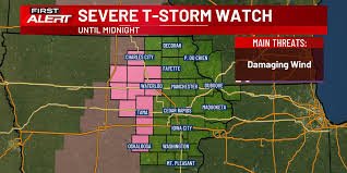
Warning: Monday has been designated as a “First Alert Day.” According to the Storm Prediction Center (SPC), the entire viewing area is under a slight risk of severe storms. The timing and track of this system are still being monitored, but residents should be prepared for strong to severe weather throughout Monday afternoon and evening.
Looking Ahead: Next Week’s Outlook
Once the Monday storm system clears out, we will see another brief window of calm. Tuesday and Wednesday will bring a mix of sun and clouds with cooler temperatures, featuring lows in the 40s and highs in the low-to-mid 60s.
However, don’t put your umbrellas away just yet. Another storm system is projected to move near the region next Thursday and Friday. Due to a more southerly track, temperatures are expected to dip below normal for the final days of April.
Stay safe and keep tracking the local forecast to stay ahead of the weather!


