
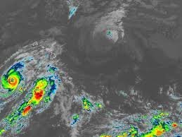
Hurricane Tracker Hawaii: Major Hurricane Lowell Heading Toward Kauai and Niihau
Residents of the Hawaiian Islands, particularly those in Kauai and Niihau, are urged to stay vigilant as Hurricane Lowell continues its dangerous trajectory. As a powerful Category 3 storm, Lowell is making a sharp turn toward the north, placing several regions under critical warnings.
If you are looking for a reliable hurricane tracker Hawaii update, the current data indicates that the storm is moving north-northeast, bringing significant risks of wind, flooding, and life-threatening surf to the islands.
Current Status and Projected Path
As of the latest reports, Hurricane Lowell maintains maximum sustained winds of 115 mph. While there has been a slight weakening, it remains a formidable Category 3 hurricane. The storm’s center is currently positioned southwest of Lihue and Honolulu, with a forecast track suggesting it will pass just west of Kauai County between late Monday and early Tuesday.
Because the track has shifted slightly eastward, the probability of hurricane-force gusts and tropical storm-force winds hitting Niihau and Kauai has increased. Local authorities have already issued Hurricane Warnings and Tropical Storm Warnings for these areas, as well as the Papahanaumokuakea Marine National Monument.
What to Expect: Wind, Rain, and Storm Surge
The impact of Hurricane Lowell will not be limited to wind alone. The combination of atmospheric pressure and moisture is expected to create hazardous conditions across the archipelago:
- n
- Extreme Winds: Hurricane conditions are possible in Kauai County by Monday evening. Note that wind speeds on hills and mountains can be up to 30% stronger than at sea level.
- Heavy Rainfall: Significant flooding is a major concern. Kauai could see between 6 to 10 inches of rain (with peaks up to 14 inches), while Hawaii Island may receive up to 12 inches in isolated areas.
- Dangerous Surf: High Surf Warnings are in effect. Waves are expected to build rapidly from 6-8 feet to a devastating 12 to 16 feet along south-facing shores.
- Tornado Threats: There is an increased possibility of tornadoes near Kauai and Niihau from Monday afternoon through Monday night.
Emergency Preparedness: Stay Safe
With a Flood Watch in effect for all Hawaiian Islands through Tuesday afternoon, now is the time to finalize your emergency plans. A Hurricane Warning typically means conditions are expected within 36 hours, leaving a very narrow window for preparation.
Essential Safety Steps:
- Secure all outdoor furniture and loose objects.
- Ensure your emergency supply kit (water, non-perishable food, batteries, and medication) is ready.
- Stay indoors and avoid coastal areas due to life-threatening rip currents and storm surges.
- Monitor official updates from the National Hurricane Center (NHC) for real-time tracking.
Other Weather Systems
In other news, the remnants of Karina have transitioned into a post-tropical cyclone northeast of Hawaii and are expected to dissipate shortly. However, this remains an exceptionally active hurricane season, making constant monitoring essential for all residents and visitors.
Stay tuned to local weather alerts and use a trusted hurricane tracker Hawaii tool to keep your family and property safe during this volatile period.



