
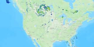
Mastering the Weather Radar Map: Your Guide to Real-Time Storm Tracking
Have you ever looked at the sky, seen dark clouds gathering, and wondered exactly when the rain would hit your neighborhood? In an era of unpredictable climate patterns, knowing how to navigate a weather radar map is no longer just for meteorologists—it is an essential skill for everyone.
Whether you are planning a weekend trip, protecting your home from potential flooding, or simply deciding if you need an umbrella, real-time weather tracking can save you time and, in some cases, potentially save lives.
What Exactly is a Weather Radar Map?
A weather radar map is a visual representation of precipitation (rain, snow, or hail) detected by radar stations. Most modern systems use Doppler radar, which not only detects where precipitation is located but also how fast it is moving and in which direction.
By analyzing these pulses of energy, weather services can create a dynamic map that updates every few minutes, providing a snapshot of the current atmospheric conditions in your area.
How to Read a Weather Radar Map Like a Pro
When you open a radar tool, you will likely see various colors dancing across the screen. Here is a quick guide to understanding what those colors mean:
- n
- Light Green: Light rain or drizzle. Generally not disruptive, but enough to get you wet.
- Dark Green to Yellow: Moderate rain. This is where you’ll start seeing steady rainfall and potential traffic delays.
- Orange to Red: Heavy rain or thunderstorms. These areas often accompany strong winds and lightning.
- Pink or Purple: Extremely intense precipitation, which often indicates hail or severe thunderstorms.
Top Tools for Real-Time Weather Tracking
Not all maps are created equal. Depending on your needs, some platforms offer more precision than others. To get the most accurate data, we recommend these high-authority sources:
- NOAA (National Oceanic and Atmospheric Administration): The gold standard for official US weather data and severe storm warnings.
- The Weather Channel: Excellent for user-friendly interfaces and hyper-local forecasts.
- AccuWeather: Great for detailed hourly breakdowns and precipitation maps.
Why Real-Time Tracking is Crucial for Safety
Using a weather radar map allows you to move from a passive role to an active one. Instead of waiting for a siren or a notification, you can see a storm cell approaching your coordinates in real-time. This is critical for:
- Early Evacuation: Identifying flash flood risks before they happen.
- Travel Planning: Avoiding dangerous highway conditions during heavy snow or rain.
- Outdoor Events: Making informed decisions about rescheduling weddings, sports, or festivals.
Final Thoughts
The technology behind the weather radar map has made the world a safer place by removing the guesswork from forecasting. By understanding the colors and utilizing trusted sources, you can stay one step ahead of the elements.
Pro Tip: Always keep a trusted weather app installed with notifications turned on for “Severe Weather Alerts” to ensure you are notified the moment the radar detects a threat in your vicinity.



