
Severe Weather Warning: What Houston Residents Need to Know
If you are in the Houston area, it is time to keep a close eye on the sky. A Weather Impact Alert has been issued for Sunday night and early Monday morning as a powerful cold front prepares to sweep across Southeast Texas. While many residents will be asleep when the weather shifts, the potential for strong thunderstorms makes preparation essential.
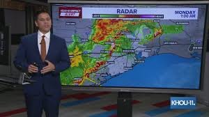
According to the latest forecasts, the most intense severe weather is expected to remain north of the Houston metropolitan area. However, local storms could still intensify, bringing unexpected disruptions to the region.
Timing and Risk Levels
The primary window of concern is from 8:00 PM Sunday through 5:00 AM Monday. Meteorologists are monitoring a layer of stable air that may act as a buffer, potentially weakening storms before they reach the city center. However, if this atmospheric shield fails, Houston could experience significant thunderstorm activity overnight.
- n
- Level 2 Severe Weather Risk: Areas north of Houston.
- Level 1 Severe Weather Risk: Harris County and the city of Houston.
- Primary Threats: Strong gusty winds and isolated hail.
Detailed Forecast Breakdown
Sunday (Mother’s Day)
The day will start with cloudy skies, gradually clearing throughout the morning and afternoon. It will be a warm day with highs reaching approximately 87 degrees. While most daytime activities should remain dry, isolated showers may develop by Sunday evening, serving as a precursor to the overnight front.
Sunday Night into Monday Morning
This is the critical period. As the front pushes into Southeast Texas after midnight, the likelihood of strong thunderstorms increases. Residents are encouraged to ensure their phones are charged and weather alerts are active.
Monday and Beyond
By sunrise on Monday, most storms are expected to have moved out of the region. The aftermath will bring a stretch of warm and humid weather. Forecast models suggest a predominantly dry pattern for the remainder of next week, with low rain chances and muggy conditions persisting.
Affected Areas
The alert encompasses several counties across Southeast Texas. If you reside in any of the following areas, stay vigilant:
- Harris County: Including Houston, Pasadena, and Baytown.
- Fort Bend County: Including Richmond, Sugar Land, and Missouri City.
- Montgomery County: Including Conroe and The Woodlands.
- Galveston & Brazoria Counties: Including Galveston, League City, Pearland, and Alvin.
- Other Impacted Areas: Liberty, Walker, Waller, Polk, Chambers, Wharton, Washington, Matagorda, Grimes, Austin, Colorado, and Trinity Counties.
For real-time updates and emergency warnings, we recommend following the National Weather Service (NWS) Houston to ensure you have the most accurate and life-saving information.


