
Severe Weather Warning: Heavy Rain Sweeps Across Southern Ontario
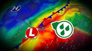
Residents across Southern Ontario are being urged to stay vigilant as a moisture-laden weather system continues to move slowly through the region. What started as a soggy Sunday is evolving into a serious weather event, with pockets of very heavy rain expected to persist well into Monday morning.
The intensity of the precipitation has already left several areas struggling. Some regions have already recorded over 75 mm of rainfall, leading to significant concerns regarding water accumulation and safety on the roads.
Rainfall Totals: Which Areas are Hit Hardest?
The impact of this system varies across the province, but the numbers are staggering. As of Sunday evening, recorded accumulations include:
- n
- Bancroft: 77 mm
- Welland: 62 mm
- Hamilton: 41 mm
- Ottawa: 27 mm (and counting)
Beyond the rain, the volatile weather prompted a tornado warning on the Niagara Peninsula, with reports of potential rotation and damage near Kemptville currently under investigation.
Focus on Eastern Ontario and the National Capital Region
As the system pushes from west to east, the brunt of the storm is now shifting toward Eastern Ontario. Areas around Ottawa and Kingston should prepare for periods of intense rainfall through Monday morning.
The National Capital Region is in a particularly vulnerable position. Having just experienced its rainiest July on record, the ground is completely waterlogged, meaning it can no longer absorb additional precipitation. This significantly increases the risk of flash flooding and standing water on major thoroughfares.
Crucial Safety Tips for Flooded Roads
With rainfall totals in some eastern sectors expected to reach between 75 mm and 100+ mm, road safety is paramount. Local authorities remind drivers of a golden rule:
Never attempt to drive across a flooded roadway. It is impossible to determine the depth of the water or the condition of the road beneath the surface until it is too late. Turn around and find an alternate route to ensure your safety and the safety of others.
For real-time updates and official warnings, we recommend monitoring Environment Canada to stay informed about the evolving conditions in your specific municipality.
Looking Ahead: The August Outlook
While the current focus is on the immediate rain threat, meteorologists are eyeing a significant “flip-flop” in weather patterns expected mid-month. Stay tuned to your local weather updates to prepare for the shifting conditions this August.



