
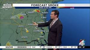
Florida Wildfire Map & Drought Alert: High Fire Risk in Jacksonville
Residents of Jacksonville and surrounding areas are on high alert as persistent dry weather continues to fuel a dangerous environmental situation. With high pressure dominating the region, the lack of precipitation has turned the landscape into a powder keg, making the Florida wildfire map a critical tool for safety and awareness.
The Growing Threat: Extreme Drought Conditions
The latest data from drought monitors indicates a worrying trend. Much of the region is currently grappling with extreme drought, and in several areas, this has escalated to an exceptional drought classification. When the soil and vegetation lose this much moisture, the risk of rapid fire spread increases exponentially.
To understand the scale of the situation, you can track real-time updates via the U.S. Drought Monitor, which provides detailed insights into the moisture deficits affecting the Southeast.
Fire Safety: Precautions and Burn Bans
Because the fire weather threat is currently high, local authorities are urging extreme caution. If you are spending time outdoors, it is imperative to stay vigilant. To prevent catastrophic wildfires, residents must strictly adhere to all burn bans currently in place.
Safety Tips to Reduce Risk:
- n
- Avoid using open flames or outdoor grills in high-wind conditions.
- Ensure all equipment that could spark is used with extreme care.
- Keep a close eye on local emergency alerts and fire maps.
- Report any signs of smoke or fire immediately to local emergency services.
n
n
n
n
For comprehensive guidelines on wildfire prevention, the Ready.gov Wildfire Page offers essential resources to protect your home and family.
Weather Outlook: When Will the Rain Return?
Unfortunately, the short-term rainfall outlook remains bleak. For the next seven days, significant rainfall is unlikely, though there is a slim 30% chance of some isolated showers later this weekend as a front approaches.
However, there is a glimmer of hope. Long-range forecasts suggest that the dry pattern may shift toward the end of April and early May, with a higher probability of above-normal rainfall returning to the area.
Quick View: 5-Day Forecast
| Day | Conditions | High/Low Temp |
|---|---|---|
| Today | Sun & Clouds, Breezy | 81°F / 55°F |
| Thursday | Sunny Sky | 84°F / 59°F |
| Friday | Mostly Sunny | 86°F / 61°F |
| Saturday | Sun & Clouds, Mainly Dry | 89°F / 63°F |
| Sunday | Isolated Rain & Storms | 90°F / 64°F |
Stay informed, stay cautious, and keep monitoring the Florida wildfire map to ensure your community remains safe during this critical drought period.


