
Extreme Heat and Windy Conditions Trigger Fire Weather Concerns Across the Southwest
Residents across New Mexico and Southern Colorado are on high alert as a powerful heat wave sweeps through the region. With temperatures soaring and humidity dropping, the risk of wildfire activity has intensified, prompting critical fire weather watch considerations and official warnings.
Searing Temperatures and Heat Advisories
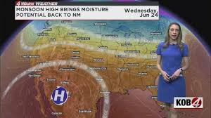
A strong monsoon high, currently centered near El Paso, is pushing daytime highs well above the 100°F mark for many lower-elevation areas. This oppressive heat has led to Heat Advisories for several regions, including:
- n
- Albuquerque Metro, Rio Rancho, and the Middle Rio Grande Valley.
- Sandia and Manzano Mountains (including Edgewood).
- West Central Highlands and the Lower Rio Grande Valley.
- Upper Tularosa Valley, South Central Mountains, and most of Lincoln County.
- Nearly all southern New Mexico counties.
Even those in mountainous locales aren’t escaping the heat, with temperatures expected to reach the upper 80s and low 90s.
Wildfire Risks: Red Flag Warnings and Firefighting Challenges
The combination of rapid daytime heating and low surface humidity is creating a volatile environment. While a formal fire weather watch has not been triggered for all of New Mexico, the conditions are significantly hindering crews battling the Deer Canyon Fire in southwest Torrance County and the Rio Fire in the Santa Fe National Forest.
Wind gusts between 15-25 mph are expected, which can cause wildfires to spread rapidly. Meanwhile, the situation is more critical in Southern Colorado, where Red Flag Warnings have been issued for Montezuma, La Plata, Archuleta, Conejos, Alamosa, and western Costilla counties. For more information on how these warnings are issued, you can visit the National Weather Service (NWS).
Is Relief on the Way? Monsoon Moisture and Storm Risks
There is a glimmer of hope for relief later this week. Tropical moisture is expected to move in, with Thursday providing the best opportunity for rain to soothe the parched landscape.
However, the transition may be turbulent. The Storm Prediction Center has highlighted a marginal risk (1 out of 5) for eastern Colfax and Harding counties, with a slight risk (2 out of 5) in the northeast corner of New Mexico. If storms develop between 4 p.m. and midnight, the primary threats include:
- Large hail
- Strong, damaging winds
Safety Tips for Extreme Heat and Fire Season
During a fire weather watch or heat advisory, it is crucial to take precautions to protect yourself and your property:
- Stay Hydrated: Drink plenty of water, even if you don’t feel thirsty.
- Limit Outdoor Activity: Avoid strenuous activity during the peak heat hours (12 p.m. – 8 p.m.).
- Be Fire Aware: Avoid using outdoor grills or equipment that could spark a fire in dry conditions.
- Monitor Alerts: Keep a close eye on local weather updates and evacuation notices.
Stay tuned for further updates as we track the movement of tropical moisture and the evolving fire risks in the Southwest.


