El Niño Weather: How a Warming Pacific is Rewriting the Global Weather Map

The Giant Awakes: Understanding the Current El Niño Phenomenon
Something massive is stirring in the Pacific Ocean. It isn’t a mythical creature, but a powerful climate driver known as El Niño. This natural phenomenon occurs every three to five years when a band of unusually warm water forms off the coast of South America. While a temperature increase of just a few degrees might seem negligible, the ocean’s capacity to hold heat is 1,000 times greater than that of the atmosphere. This means a slight shift in ocean surface temperatures can inject a staggering amount of energy into the sky, fundamentally altering el niño weather patterns worldwide.
Scientists are currently observing one of the strongest El Niño events on record. While researchers are still debating the exact extent to which climate change is amplifying these events, the result is clear: we are entering a period of volatile and often dangerous weather shifts.
Global Consequences: From Droughts to Deluges
The impact of a super El Niño is not confined to one region; it is a global domino effect. The additional heat trapped in the atmosphere can lead to severe humanitarian crises. Current estimates suggest that the resulting extreme weather could impact hundreds of thousands of people globally.
- n
- The Amazon Rainforest: Gripped by severe drought, increasing the risk of forest fires.
- The Horn of Africa: Facing extreme rainfall and catastrophic flooding.
- The Polar Vortex: Interacting with El Niño to scramble winter temperatures across North America.
Regional Breakdown: What to Expect Across the United States
Because atmospheric changes are so complex, the U.S. will experience a fragmented set of impacts. According to data from the National Oceanic and Atmospheric Administration (NOAA), the general trend suggests a warm North and a wet South.
1. The West Coast: A Tale of Two Extremes
California is bracing for an onslaught of moisture. The state is preparing for “atmospheric rivers”—massive plumes of moisture that can cause severe coastal erosion and urban flooding. While this helps replenish reservoirs, it also creates a dangerous paradox: more rain leads to more vegetation, which, once dried out by a hot summer, becomes fuel for catastrophic wildfires.
Conversely, the Pacific Northwest may see a rerouted storm track. This often results in warmer, drier winters, which threatens the mountain snowpack—the primary water source for the region’s drinking water and hydropower.
2. The Midwest and Northern Plains
The Midwest might actually find some relief this winter. El Niño typically pushes the polar jet stream northward, leading to milder and drier winters. While this means fewer freezing days, it could also result in a quieter tornado season in the spring.
In the Northern Great Plains (Montana, Dakotas), the outlook is more uncertain. While warmer temperatures are expected, precipitation is a toss-up, leaving farmers and ranchers anxious about whether the drought will persist or break.
3. The South and Southeast
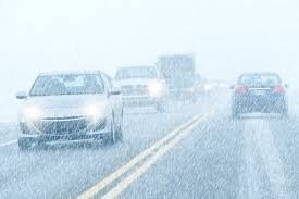
For the Southeast, prepare for a wet and unpredictable winter. The combination of Gulf moisture and Arctic air often leads to ice storms, which can cause widespread power outages and hazardous road conditions. On a positive note, El Niño usually suppresses Atlantic hurricane formation, though South Florida remains vulnerable.
The Southwest and Southern Great Plains (Texas, New Mexico) are seeing a glimmer of hope. Increased precipitation could provide much-needed relief to drought-stricken basins and desiccated reservoirs like Lake Mead.
4. Alaska and Hawai’i
Alaska is facing a double threat. Already warming faster than anywhere else on Earth, El Niño adds a blast of heat that thaws permafrost and erodes shorelines. Hawai’i, meanwhile, faces a drier winter and spring, significantly elevating the risk of wildfires in areas where vegetation has grown thick from previous wet seasons.
Preparing for the “New Normal”
El Niño is a reminder that our global climate is deeply interconnected. As planetary temperatures continue to rise, these “temporary” weather shifts may soon become the default baseline. Whether it is implementing “sponge infrastructure” in cities like Los Angeles to manage floodwaters or clearing dry brush in Hawai’i, adaptation is the only way forward.
Stay informed by monitoring local meteorological updates and understanding that in an era of climate instability, the weather is becoming increasingly weird—and we must be ready.
📰 You May Also Like