
Click on Detroit Weather: Flood Watch in Effect for Southeast Michigan
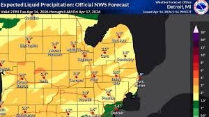
Southeast Michigan is bracing for significant rainfall, with up to four inches possible. The National Weather Service has issued a flood watch for all of metro Detroit, starting at 8 p.m. on Tuesday, April 14th, and continuing through late Thursday night, April 16th. Residents are urged to prepare for potential flooding and severe weather conditions.
Multiple Rounds of Storms Expected
Several rounds of showers and thunderstorms are anticipated to move through the area beginning tonight. The National Weather Service (NWS) Detroit/Pontiac office has highlighted an enhanced risk – the third-highest of five risk levels – for large hail, damaging winds, and isolated tornadoes south of Interstate 69. This elevated risk necessitates heightened awareness and preparedness.
GLWA Prepares for Heavy Rainfall
The Great Lakes Water Authority (GLWA) is proactively preparing for the storm. Navid Mehram, GLWA’s chief operating officer of wastewater operating services, stated in a news release that the regional system is fully dewatered and within its design capacity to handle the predicted rainfall. “GLWA is closely monitoring conditions, and the wastewater conveyance system has been fully reviewed to ensure operational readiness,” Mehram confirmed. However, residents in low-lying and flood-prone areas are still advised to take precautions.
Affected Cities and Potential Impacts
The flood watch encompasses a wide range of cities, including Adrian, Ann Arbor, Bad Axe, Bay City, Caro, Detroit, Flint, Howell, Lapeer, Midland, Monroe, Owosso, Pontiac, Port Huron, Saginaw, Sandusky, and Warren. The NWS warns that excessive runoff could lead to flooding of rivers, creeks, streams, and other low-lying areas. Creeks and streams may overflow their banks, and urban areas with poor drainage are particularly vulnerable. Low-water crossings may also become flooded and impassable.
Severe Weather Potential Continues Wednesday
The threat of severe weather doesn’t end with Tuesday’s storms. Wednesday could bring additional storms with an isolated risk of severe weather, including hail and winds up to 60 mph. Despite the inclement weather, temperatures will remain unseasonably warm, with a high of 75 degrees and a low of 61 degrees.
Stay Informed and Stay Safe
It’s crucial to stay updated on the latest weather forecasts and warnings. You can find more information and real-time updates from the National Weather Service and ClickOnDetroit’s weather page. Remember to move valuable items from basements and be prepared for potential power outages.
Source: Detroit Free Press


