
The Surge is Coming: Understanding the 2026 El Niño Intensity Forecast
After a prolonged period of La Niña, the equatorial Pacific is shifting gears. Current meteorological data and computer models are pointing toward a significant warming event. In fact, the 2026 El Niño intensity forecast suggests we aren’t just looking at a standard cycle, but potentially a “Super El Niño.”
But what does this mean for the planet, and why should we be concerned? Let’s dive into the science and the projected impacts of this climatic phenomenon.
What Exactly is a “Super El Niño”?
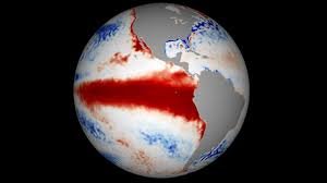
An El Niño event occurs when waters in the central and eastern equatorial Pacific Ocean warm up periodically, disrupting global weather patterns. While these happen every few years, a “Super El Niño” is a rarer, more intense version where sea-surface temperatures rise at least 2 degrees Celsius above average.
According to recent data from the National Oceanic and Atmospheric Administration (NOAA) and the European Centre for Medium-Range Weather Forecasts (ECMWF), some models suggest temperatures could peak at 2.5 degrees above average by autumn 2026. This would place it among the most intense events ever recorded, potentially rivaling the massive shifts seen in the 1870s.
The Science Behind the Warming: Westerly Wind Bursts
One of the primary drivers fueling this intensity is the occurrence of westerly wind bursts. These are powerful surges of wind blowing from west to east near the equator in the western Pacific. These bursts act like a conveyor belt, pushing warm surface waters eastward and rapidly heating the eastern Pacific.
Experts have noted that some of these bursts in early 2026 were among the strongest in decades, significantly increasing the confidence that a high-intensity event is underway.
Global Impacts: What to Expect in 2026 and 2027
A Super El Niño doesn’t just warm the ocean; it reshapes the atmosphere. Here is how the 2026 forecast could affect different regions:
- Hurricane Seasons: Historically, strong El Niño events create high wind shear in the Atlantic, which typically leads to a quieter Atlantic hurricane season. Conversely, the central and eastern Pacific often see an increase in storm activity.
- Winter Weather (North America): We may see a “turbocharged” subtropical jet stream. This often results in wetter and snowier winters for the southern United States and parts of Mexico, while the northern U.S. and Canada typically experience milder and drier conditions.
- Global Precipitation: Certain regions, including Australia, Indonesia, the Philippines, and parts of Africa, are expected to face markedly drier conditions. Meanwhile, heavier rainfall is forecast for Peru, Ecuador, and eastern Africa.
The Climate Change Connection: A New Heat Record?
The most certain outcome of the 2026 El Niño intensity forecast is a spike in global temperatures. As the ocean releases massive amounts of heat into the atmosphere, and dry conditions allow more sunlight to hit the earth’s surface, global heat records are likely to be shattered.
Given that recent years have already been the warmest on record, the combination of a Super El Niño and ongoing climate change is worrisome. Research from the ECMWF suggests that these events can trigger sudden “climate regime shifts,” making extreme weather more frequent and unpredictable.
Final Thoughts
While every El Niño is unique, the signals for 2026 are loud and clear: we are preparing for an event of historic proportions. Whether it’s preparing for a milder winter in the north or bracing for droughts in the south, staying informed is key to navigating the volatility of our changing climate.


