
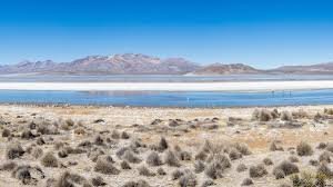
The Art and Science of Weather Forecasting: Exploring the Diverse Climates of Peru
Have you ever wondered how a simple glance at the sky evolved into the complex digital forecasts we rely on today? Weather forecasting is far more than just deciding whether to carry an umbrella; it is a sophisticated blend of historical observation and cutting-edge mathematical modeling that impacts global infrastructure.
The Evolution of Predicting the Skies
For centuries, humans have attempted to decode the atmosphere. Long before the common era, early civilizations relied on the observation of cloud patterns, wind direction, and seasonal cycles. While these early attempts were often imprecise, they laid the groundwork for modern meteorology.
The real revolution occurred with the advent of computing. Today, the World Meteorological Organization (WMO) and other global entities utilize complex mathematical models and satellite data to provide high-precision forecasts. This technological leap is critical for several key sectors:
- n
- Transport: Ensuring safety in aviation, maritime navigation, and road travel.
- Agriculture: Helping farmers optimize planting and harvesting cycles.
- Public Safety: Providing early warnings for natural disasters to save lives.
- Health: Managing public health responses to extreme heat or cold waves.
Spotlight on Arequipa: A Study in Altitudinal Weather
To understand how geography influences weather, let’s look at Arequipa, Peru. This region is a perfect example of how altitude creates distinct microclimates. For instance, a typical winter day (such as July 18th) in Arequipa showcases the city’s arid and temperate nature:
- Temperature: Highs of 23°C and lows of 8°C.
- Precipitation: Virtually non-existent (around 0-1% probability).
- Wind: Gusts reaching up to 33 km/h during the day.
- UV Index: Reaching levels up to 7, necessitating sun protection.
In Arequipa, the weather shifts dramatically as you climb. While the city remains temperate, areas above 4,000 metres experience semi-frigid conditions, and the volcanic peaks exceeding 5,000 metres host glacial climates, proving that geography is the ultimate architect of weather.
Peru: A Land of 38 Microclimates
Peru is one of the most climatically diverse countries on Earth. According to the National Service of Meteorology and Hydrology (Senamhi), the country boasts 38 different types of climates. This extraordinary variety is caused by the interaction between the Tropic of Capricorn and the towering presence of the Andes Mountains.
These diverse conditions can be categorized into three primary zones:
- The Coast: Occupying about 11.6% of the territory, this region is predominantly arid and temperate, characterized by a significant lack of rainfall.
- The Highlands (Sierra): Covering 28.1% of the land, the area surrounding the Andes is typically cold and rainy.
- The Jungle (Selva): The largest region (60.3%), defined by a tropical climate that is both warm and heavily rainy.
Understanding these patterns allows us to appreciate the complexity of our planet’s atmosphere and the vital importance of the technology that helps us navigate it every day.



