
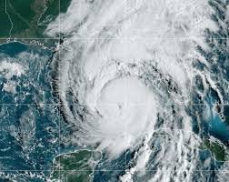
Critical Update: GOES-19 Satellite Outage Impacts NOAA Hurricane Tracking
In a worrying development for meteorological monitoring, the National Oceanic and Atmospheric Administration (NOAA) has announced that a pivotal tool for Atlantic weather surveillance is currently unavailable. The GOES-19 satellite, a cornerstone for tracking tropical developments, has entered a “safehold” mode, leaving engineers racing to restore its functionality.
Why GOES-19 is Essential for Hurricane Forecasting
The GOES-19 is not just another satellite; it is the primary instrument used to identify and monitor tropical waves as they intensify across the Atlantic basin, the Caribbean, and the Gulf of Mexico. Its capabilities are vital for providing the real-time data necessary for accurate forecasting and public safety warnings.
Specifically, the satellite provides critical data on:
- n
- Tropical Wave Movement: Tracking the early stages of storm formation.
- Atmospheric Patterns: Monitoring lightning strikes and cloud formations.
- Ocean Temperatures: Analyzing the heat energy that fuels hurricanes.
- Regional Monitoring: Providing essential data for residents along the Gulf Coast, including Louisiana.
How NOAA is Maintaining Safety During the Outage
Despite the technical setback, NOAA and the National Hurricane Center (NHC) have emphasized that tracking has not stopped. To ensure there are no gaps in critical weather surveillance, experts have pivoted to backup systems.
The GOES-16 satellite is currently serving as the primary alternative, ensuring that forecasters can still monitor the Atlantic for potential threats. While the recovery timeline for GOES-19 remains undetermined, the Office of Satellite Operations (OSPO) is working diligently to bring the instrument back online.
The Future of Forecasting: Integrating Artificial Intelligence
This incident highlights the importance of diversifying tracking methods. Interestingly, the weather community is already looking toward the future to supplement satellite data. Last year, forecasters introduced AI weather model guidance into hurricane forecasting for the first time—a trend that is expected to expand significantly through 2026.
The synergy between satellite imagery and AI-driven predictive analytics promises to create a more resilient and accurate early-warning system for coastal communities.
Stay Informed and Prepared
For those living in hurricane-prone areas, staying updated through official channels is the best way to ensure safety. You can find the latest technical updates on the satellite’s status via the NOAA official website and get real-time tropical outlooks through the National Hurricane Center.



