
Severe Weather Warning: Tornadoes and Powerful Storms Sweep Across the Canadian Prairies
Residents across the Canadian Prairies are on high alert as a volatile weather pattern continues to linger. A critical weather warning is currently in effect, with severe risks encompassing significant portions of Alberta and Manitoba. From destructive hail to torrential rains and powerful wind gusts, the region is bracing for a series of high-impact atmospheric events.
Tornado Alerts in Southern Manitoba: A Life-Threatening Situation
The situation escalated rapidly on Sunday evening when Environment and Climate Change Canada (ECCC) issued urgent tornado warnings for several areas in southern Manitoba. The affected regions include:
- n
- Municipality of Bifrost-Riverton (including Arborg, Hnausa, and Hecla)
- Municipality of Glenboro-South Cypress (including Treesbank)
- Municipality of Oakland-Wawanesa (including Carroll)
Officials have stressed that this is a dangerous and potentially life-threatening situation, urging all residents in these zones to take immediate cover.
- Move Indoors: Head to the lowest floor of a sturdy building.
- Find a Safe Room: Choose a basement, bathroom, stairwell, or interior closet—stay away from outside walls and windows.
- Abandon Temporary Shelters: Leave mobile homes, vehicles, tents, and trailers immediately.
- Last Resort: If caught outside, lie flat in a low spot and protect your head from flying debris.
Regional Breakdown: Alberta and Saskatchewan
While Manitoba faces the highest risk of tornadic activity, the rest of the Prairies are not immune. A tornado watch remains in effect for southern Saskatchewan and southern Manitoba, meaning conditions are highly favourable for tornado development.
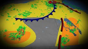
In Alberta, specifically around Calgary and Medicine Hat, the risk of large hail and strong wind gusts is significant. A cold front associated with a low-pressure system is driving these thunderstorms, which began developing mid-afternoon.
Forecast: Rainfall and Wind Expectations
As the low-pressure system tracks eastward toward northwestern Ontario, the weather will remain unstable. Here is what you can expect over the coming days:
- n
- Wind Gusts: Overnight gusts could reach approximately 60 km/h in central Manitoba and southern Alberta.
- Rainfall Totals: While most of the Prairies will see 10 to 15 mm of rain, northeastern Alberta and northwestern Ontario could be hit with over 50 mm due to multiple storm rounds.
Staying Prepared
High-impact weather is expected to persist through the end of June. We strongly recommend that residents keep a close eye on official alerts and have a predefined emergency plan for their home or workplace. For more information on emergency preparedness, visit Get Prepared Canada.
Stay tuned for further updates as the system moves across the region. Your safety depends on staying informed.



