Extreme East Coast Heat: From NYC Weather Trends to DC’s Record-Breaking July 4th Storms

Heatwave Chaos: Record-Breaking Temperatures Grip the East Coast
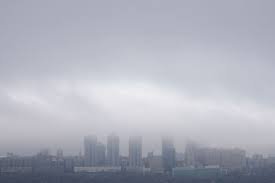
While residents across the Northeast have been closely monitoring the volatile nyc weather and humidity levels, Washington D.C. just experienced a Fourth of July for the history books—and not for the right reasons. A combination of oppressive heat and sudden, violent thunderstorms turned the semiquincentennial celebrations into a battle against the elements.
The intensity of the weather was so severe that visitors at the National Mall were forced to briefly evacuate, causing delays in the highly anticipated fireworks display. This event is part of a broader pattern of extreme weather currently affecting the East Coast corridor, where record-breaking temperatures are becoming the new norm.
A Day of Broken Records
The heat wasn’t just uncomfortable; it was historic. Several regional airports reported temperatures that shattered records dating back over a century:
- n
- Reagan National Airport: Hit a scorching 102°F, breaking a record set in 1919.
- BWI Marshall: Reached 102°F, surpassing the previous record of 100°F from 1898 and 1966.
- Dulles Airport: Tied its all-time high of 97°F, a mark previously hit in 1999 and 2002.
Beyond the thermometer, the air quality reached dangerous levels. The region was placed under a “code purple” air quality alert, signaling conditions that are unhealthy for the general population. For more information on how to protect yourself during extreme heat, check the official guidelines from the National Oceanic and Atmospheric Administration (NOAA).
Storms, Power Outages, and Danger
As the day progressed, the searing heat gave way to powerful thunderstorms. These weren’t just passing showers; heavy wind gusts caused significant damage across the D.C. and Maryland regions. Reports indicated downed trees and widespread power outages, including a notable incident in Hyattsville, Maryland, where a large tree was uprooted near Landover Hills.
Looking Ahead: What to Expect Next
Unfortunately, the relief from the humidity is only temporary. If you are tracking the regional trends—similar to the unpredictable nyc weather—prepare for a challenging few days ahead:
- n
- Sunday: Expect a mix of clouds, high humidity, and severe afternoon storms. Highs will linger between 95°F and 100°F.
- Monday: More storms are predicted, with heavy rain that may lead to localized flooding. Highs will be slightly lower, between 85°F and 90°F.
- Tuesday: A gradual cooling trend with scattered showers and highs in the 80s.
Whether you are in the heart of the capital or keeping an eye on the weather in the surrounding metropolitan areas, staying hydrated and remaining indoors during peak heat hours is critical. Stay tuned for more breaking updates on this historic summer heatwave.
📰 You May Also Like