
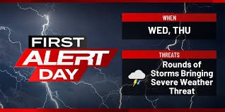
First Alert Day: Severe Storms and Tornado Risks Loom Over Eastern Iowa
Residents of eastern Iowa need to stay vigilant over the next 48 hours. According to the latest KCRG weather reports, the region is entering a highly volatile period, with two consecutive “First Alert Days” declared. The atmosphere is primed for strong to severe storms that could bring significant disruptions and danger.
What to Expect Today: A Two-Wave Storm Threat
Weather patterns indicate that today’s activity will likely occur in two distinct phases. Whether you are commuting or planning evening activities, keeping an eye on the radar is essential.
Phase 1: The Morning Window
Between 10:00 a.m. and 1:00 p.m., scattered storms are expected to develop. While they may start out isolated, there is a high probability of these cells organizing quickly, bringing the threat of:
- n
- Large, damaging hail.
- Powerful wind gusts.
- Localized severe weather bursts.
n
n
n
Phase 2: Afternoon and Evening Intensity
The risk increases significantly after 3:00 p.m. to 4:00 p.m. as a frontal boundary pushes into the area. Due to the unstable atmospheric ingredients, storms are expected to turn severe rapidly. During this window, the primary concerns are damaging winds (especially in storm lines) and the potential for tornadoes (more likely in isolated, individual cells).
Looking Ahead: Thursday’s Enhanced Risk
If you thought the weather would settle, think again. Thursday is also designated as a First Alert Day. The Storm Prediction Center (SPC) has placed much of the region under an “Enhanced Risk” (indicated in orange), with some areas remaining under a slight risk.
Thursday’s expected timeline includes:
- n
- Morning: A cluster or line of storms originating from Nebraska and western Iowa is expected to move east. The main threat here will be damaging winds and hail, with a chance of isolated tornadoes.
- Afternoon/Evening: Depending on how much energy the morning storms consume, a second round of severe weather could develop. If the atmosphere recovers, all severe hazards—including tornadoes—will be back on the table.
n
n
Heavy Rainfall and Flooding Concerns
Beyond the wind and thunder, moisture levels are high. Forecasters predict 1 to 2 inches of new rainfall over the next few days, with some isolated areas seeing even higher totals. This brings a risk of isolated flash flooding. While river levels are currently low, making widespread river flooding unlikely, low-lying areas should remain cautious.
How to Stay Safe and Informed
In severe weather situations, every second counts. We strongly urge everyone in the Cedar Rapids and eastern Iowa area to remain weather-aware. For real-time updates and the most accurate KCRG weather tracking, utilize these resources:
- n
- Visit KCRG.com for the latest blogs and alerts.
- Tune in to KCRG-TV9 for live breaking coverage.
- Download the KCRG First Alert Weather app for instant notifications on your mobile device.
n
n
n
Stay safe, stay prepared, and keep your weather alerts turned on!


