
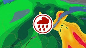
Spring Surprise: Heavy Rainfall and Flood Risks Hit Quebec
After several days of unexpectedly mild and sunny weather that felt like a premature start to summer, Quebec is in for a sudden wake-up call. According to the latest meteo quebec updates, the sunshine is being replaced by a series of powerful rain systems that will sweep across the province starting this Wednesday.
For many residents, the “spring festival” of warm weather is ending abruptly, making way for significant precipitation that could bring complications to several regions.
What to Expect: The Rainfall Forecast
The weather shift will occur in two distinct waves, bringing varying levels of intensity depending on your location:
- First Wave (Wednesday to Thursday): Heavy precipitation will primarily impact the southern and central parts of the province.
- Second Wave (Friday to Saturday): A second surge of rain will move from west to east, further increasing accumulation totals.
Regional Breakdown: Who is Most Affected?
While the entire province will feel the shift, some areas are at higher risk than others. If you are tracking meteo quebec for your specific city, here is the outlook:
- Outaouais, Mauricie, and Saguenay–Lac-Saint-Jean: These regions are bracing for significant totals, with 40 to 60 mm of rain expected by Thursday evening.
- Charlevoix and Central Quebec: This area is particularly vulnerable, with total accumulations potentially exceeding 75 mm by Saturday.
- Greater Montreal: The metropolis will not be spared, but the impact should be less severe, with predicted rainfall between 10 and 20 mm.
The Danger of Rapid Snowmelt and Flooding
The primary concern for meteorologists isn’t just the rain itself, but what is already on the ground. In several high-altitude sectors, significant snowpack remains. For instance, as of late April, 42 cm of snow was still reported at Le Massif in Charlevoix.
“With the heavy precipitation forecast, especially in central Quebec, the rain will inevitably accelerate the melting of the snow still on the ground. The potential for flooding is very real for these regions,” explains meteorologist Alexandra Giroux.
Current data from Quebec Public Security already indicates a precarious situation, with 15 hydrometric stations reporting minor flooding and two reporting moderate flooding. With the incoming rain, these numbers are expected to rise.
Stay Safe and Informed
We encourage all residents in high-risk zones to monitor local alerts and prepare for potential water level rises. For real-time updates and official government warnings, you can visit Environment Canada, the gold standard for meteorological data in the country.
Keep an eye on the meteo quebec trends to plan your weekend and ensure your property is protected from potential runoff and flooding.


