
Dramatic Temperature Drop: Severe Cold Front and Storms Sweep Across North America
Get ready to grab your heaviest coats and scarves. A powerful cold front is currently tearing across the eastern half of the continent, triggering a drastic temperature drop that has left millions bracing for freezing conditions. From the Midwest to the Northeast, the weather is shifting rapidly, while a separate, intense Pacific storm system is bringing chaos to the West Coast.
The Big Freeze: Eastern U.S. Under Pressure
According to the National Weather Service (NWS), the eastern regions are experiencing some of the most severe conditions behind the front. Daytime highs are struggling to climb above the 40s and 50s across the Midwest and Northeast, creating a stark contrast to previous weeks.
The real danger, however, arrives overnight. Temperatures are expected to plummet into the 20s and 30s across the Ohio Valley and the interior Northeast. This has prompted urgent freeze warnings, even in areas like North Carolina, where below-freezing temperatures are appearing well after the typical last frost date.
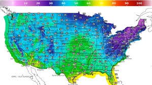
Regional Temperature Breakdown:
- Great Lakes & Interior Northeast: Widespread lows in the 20s and 30s.
- Midwest: Highs hovering in the 40s.
- Mid-Atlantic: Lower 50s, with freezing pockets inland.
- Southeast & Florida: Relatively mild, with lows remaining in the 60s and 70s.
“The dramatic temperature drop will lead to widespread frost and freeze conditions,” warns Brett Anderson, senior meteorologist at AccuWeather. “The biggest concern is the window where high pressure builds, creating ideal cooling conditions under clear skies.”
West Coast Chaos: Heavy Rain and Mountain Snow
“The dramatic temperature drop will lead to widespread frost and freeze conditions,” warns Brett Anderson, senior meteorologist at AccuWeather. “The biggest concern is the window where high pressure builds, creating ideal cooling conditions under clear skies.”
While the East freezes, the West is battling a deep Pacific storm moving inland. This system is delivering a double blow: torrential rain in the valleys and massive snow accumulations in the peaks.
In the Sierra Nevada, snowfall totals could reach between 1 to 2 feet by Tuesday. Meanwhile, Northern and Central California are on high alert for potential flooding due to repeated rounds of heavy precipitation. The storm’s reach is expanding, impacting the Pacific Northwest, the Great Basin, and Southern California.
Storms in Texas and a Brief Central Warm-up
The weather volatility doesn’t end there. In Texas, a lingering frontal boundary is fueling daily thunderstorms. Forecasters are warning of isolated flash flooding, particularly in central Texas and along the upper Gulf Coast.
Interestingly, the central U.S. will enjoy a brief respite. High pressure is expected to push temperatures back into the 70s and 80s across the Plains mid-week, before cooler air filters in from the West once again.
Gardening Alert: How to Protect Your Plants
One of the most significant risks of this sudden temperature swing is the potential for agricultural damage. Because of an unusually warm start to the season, many plants have blossomed ahead of schedule, making them highly vulnerable to a hard freeze.
Expert Tips to Protect Your Garden:
- Cover Sensitive Plants: Use frost blankets or burlap to shield buds and blossoms.
- Water Your Soil: Moist soil absorbs more heat during the day and releases it slowly at night.
- Move Potted Plants: Bring container gardens indoors or into a garage to avoid overnight lows.
Tyler Roys, another senior meteorologist at AccuWeather, emphasizes that even a few hours of sub-freezing temperatures can significantly devastate fruit production for the entire season.
Stay tuned for more updates as this weather system evolves. For real-time alerts, check your local weather office and keep a close eye on the thermometer!


