Fire Weather Watch: North Florida Braces for Critical Wildfire Conditions
Forecasters are urgently warning residents of North Florida about a sustained and elevated threat of critical fire weather conditions throughout the weekend. This comes as the state grapples with one of its most severe wildfire seasons on record, exacerbated by a prolonged and intensifying drought.
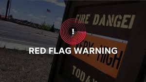
Red Flag Warning Issued
The National Weather Service (NWS) in Tallahassee issued a Red Flag Warning at 2:27 a.m. on Saturday, April 18th, encompassing Calhoun, Gadsden, Leon, Inland Jefferson, Madison, Inland Wakulla, Northern Liberty, Southern Liberty, Mitchell, Colquitt, Cook, Decatur, Grady, Thomas, Brooks, and Lowndes counties. This warning remains in effect through the night, with a Fire Weather Watch extending into the weekend, and the potential for further warnings.
“A Red Flag Warning signifies that critical fire weather conditions are either present or imminent,” explain forecasters. “The combination of strong winds, low relative humidity, and warm temperatures dramatically increases the risk of extreme fire behavior.”
Historic Drought Fuels the Threat
The situation is particularly concerning given the region’s current state of drought – the worst in decades. The area is experiencing a rainfall deficit exceeding 20 inches, creating exceptionally dry fuels readily susceptible to ignition and rapid spread. You can find more information about drought conditions in Florida at the U.S. Drought Monitor.
Detailed Forecast & Conditions
According to the NWS statement issued at 2:27 a.m.:
- Today: Temperatures are expected to reach 88-92°F, nearing record highs. The Hot Dry Windy Index is already exceeding the 90th percentile, a level typically seen in early May.
- Sunday: A dry cold front will bring northerly wind gusts of 20-25 mph. While lingering cloud cover may slightly inhibit fire behavior, critical conditions remain possible, particularly in the afternoon.
- Monday: A very dry air mass will move over the region, with minimum relative humidity levels dropping to 15-20%. Sustained northeast winds of 10-15 mph will further contribute to extremely high fire dispersion. Full sunshine, warm temperatures, and ongoing drought will create a highly critical fire weather environment.
“Any fires that develop will likely spread rapidly,” the NWS warns. Outdoor burning is strongly discouraged.
Understanding Fire Weather Alerts
A Fire Weather Watch or Red Flag Warning is issued when dry fuels combine with weather conditions to create an environment conducive to extreme fire danger. Each NWS office establishes local criteria for these alerts.
Protecting Your Property & Community
Residents under a Red Flag Warning are urged to take extra precautions to prevent wildfires. Many counties, including Leon County, are currently under extended burn bans. Here’s how to reduce the risk:
- Monitor Local Alerts: Stay informed about the latest warnings and advisories from the NWS and local authorities.
- Prepare Your Home & Property: Clear brush and debris around your home, and ensure gutters are free of leaves.
- Have an Emergency Kit Ready: Include essential supplies like water, food, medications, and a first-aid kit.
- Avoid Activities That Could Start a Fire: Refrain from outdoor burning, using fireworks, or operating equipment that could generate sparks.
- Electrical Safety: Ensure electrical equipment is properly maintained and avoid overloading circuits.
- Health Precautions: Be aware of the health risks associated with smoke inhalation.
Portions of this report were generated automatically using information from the National Weather Service.
Stay updated on the latest weather alerts and forecasts here.