Boston Weather Rollercoaster: Brace for Chills, Rain, and a Potential Snowstorm!
Get ready, Boston! The coming week promises a classic New England weather mix, taking us from bright, blustery days to a significant rain event, all culminating in the season’s first potential widespread plowable snow. Staying informed about the ever-changing Boston weather forecast is key to navigating the week ahead.
Today’s Chill: Sunny but Gusty!
While the skies above Boston will be brilliantly clear today, don’t let the sunshine fool you. Highs will hover in the low 40s, but persistent, gusty winds reaching 20-25 mph will make it feel much colder – closer to freezing even during the warmest part of the afternoon. It’s definitely a day to bundle up and enjoy the crisp air responsibly!
Sunday’s Shift: Rain Rolls In
As we head into Sunday, clouds will begin to gather overnight, setting the stage for a significant change. Temperatures will dip into the mid to upper 20s tonight, but by Sunday afternoon, a mild air mass will push in with widespread rain showers. Expect temperatures to climb to around 50 degrees as the rain becomes more prevalent after noon, continuing through much of the evening. Winds will also pick up, adding to the blustery feel.
Monday: A Brief Return to Sunshine and Chill
Monday offers a brief respite from the wet weather, mirroring today’s conditions. It will start off cold in the low 30s, with highs reaching the low 40s under bright, sunny skies. However, a noticeable breeze will once again contribute to a chilly overall feel, reminding us that winter is firmly in control of the New England weather scene.
Tuesday’s Watch: The Season’s First Plowable Snow?
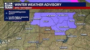
All eyes will be on Tuesday as a developing storm system brings the chance for the first widespread plowable snow of the season to parts of the Boston area. While details are still evolving, the storm’s exact track will be crucial in determining snowfall totals. Currently, areas north and west of Boston have the highest likelihood of seeing significant accumulation, while south and east of the city are more likely to experience mostly rain. This is a dynamic situation, and we urge everyone to stay tuned for the latest updates on this potential Boston snowstorm.
What to Expect if Snow Hits:
- Potential travel disruptions, especially during peak hours.
- Need for proper winter gear and vehicle preparation.
- Vigilance for official advisories and school closures.
Mid-Week Outlook: Back to Frigid Temps
Don’t expect the wintry weather to linger too long after Tuesday. Wednesday will bring partly sunny skies with temperatures ranging from the 20s to 30s. Thursday looks cloudy with similar frigid lows in the 20s and highs in the 30s, accompanied by a breezy feel. The week wraps up quietly but bone-chillingly on Friday, with morning temperatures potentially dropping into the single digits and teens before rebounding slightly to the low 30s in the afternoon. Be prepared for these fluctuating Boston temperatures.
Stay Informed and Prepared!
With such a dynamic forecast, staying informed is paramount. Keep an eye on local weather reports and be prepared for rapidly changing conditions. Whether it’s bundling up for the wind, grabbing your umbrella for the rain, or getting ready for potential snow, Boston’s weather demands your attention this week. Stay safe out there!


