
Vancouver’s Unusual Winter: A Snowless Outlook?
Vancouver, British Columbia, is on the verge of making history. As of March 10, 2026, the city is edging closer to an official snowless winter, a phenomenon not seen since the winter of 1982-83. Despite a recent chilly spell, the benchmark of one centimetre of snow accumulation at Vancouver International Airport (YVR) remains unmet.
Environment Canada meteorologist Terri Lang reported that while up to four centimetres of snow were initially forecast for Metro Vancouver’s sea-level regions, YVR recorded no accumulation on Tuesday morning. This has sparked considerable discussion about the reasons behind the lack of snowfall, with residents and officials alike trying to understand the unusual weather pattern.
Impact on Travel and Drive BC Updates
If Vancouver manages to go without snow by March 21st – the first day of spring – it will mark a significant departure from typical winter conditions. The airport has already experienced its first snow-free December-to-February period since 2014-15. This has potential economic benefits, as YVR may save on de-icing fluids and avoid snow-related flight delays. However, it’s crucial for drivers to stay informed about conditions elsewhere in the region.
While Vancouver itself may remain snow-free, other areas of southwestern British Columbia are experiencing winter weather. Communities like Whistler, Tofino, and Campbell River have reported snowfall. Furthermore, elevated areas of Metro Vancouver still face significant snowfall risks, particularly on highways like the Coquihalla and the Sea to Sky. Drive BC is actively monitoring these conditions and providing updates to travellers.
Winter Storm Watch and Travel Advisories
Environment Canada has issued a winter storm watch for the Coquihalla, Highway 3, and the Okanagan Connector, forecasting up to 15 centimetres of snow and wind gusts up to 100 kilometres per hour. Drivers planning travel in these areas are strongly advised to check Drive BC for the latest road reports and conditions before embarking on their journey. You can find up-to-date information on the Drive BC website.
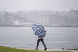
The current weather situation is a result of a cold, unstable air mass. Even areas experiencing rain should be aware that conditions can change rapidly, especially in mountain passes. Lang emphasizes, “If it’s raining where you are, you don’t often think that it could be snowing, especially through those mountain passes.”
Potential for Flooding and Atmospheric River
Looking ahead, another concern is the potential for flooding. An approaching atmospheric river system is expected to bring rain and warmer temperatures, leading to snowmelt. This could increase the risk of flooding in some areas. Staying informed through Drive BC and Environment Canada alerts is vital.
Stay Informed with Drive BC
As Vancouver navigates this unusual winter, staying informed is key. Drive BC provides real-time updates on road conditions, weather alerts, and travel advisories. Remember to check the website before you travel and be prepared for changing conditions. For more information on weather forecasts, visit the Environment Canada website.


