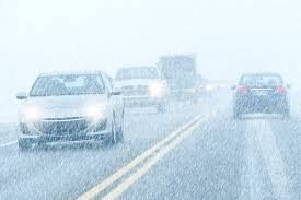
Storm Warning: Volatile Météo and Heavy Winds Expected to Hit France Next Week

Prepare for Impact: A Week of Turbulent Weather Ahead in France
If you have plans in France for the coming week, it is time to double-check your itinerary. The météo outlook is taking a sharp turn for the worse, as a series of atmospheric depressions are expected to sweep across the country, bringing violent winds and heavy precipitation.
After a brief period of calm, the Atlantic is preparing to send several disturbances in quick succession. According to forecasts, the week of November 16th to 22nd will be characterized as “agitated, windy, and rainy,” creating potentially hazardous conditions for travel and outdoor activities.
The Danger Timeline: When to Be Most Alert
While the weather will be unstable throughout the week, meteorologists have identified specific windows of high risk. Here is the breakdown of what to expect:
- n
- Sunday, November 15: The return of rain and increasing wind speeds across various regions.
- Monday, November 16: An additional perturbation arrives, maintaining the unstable conditions.
- Tuesday, November 17: The Critical Window. Forecasts from Météo-Paris suggest a depression could rapidly intensify over England, potentially triggering storm-level conditions in several French regions.
- Wednesday, Nov 18 – Thursday, Nov 19: The instability continues with a secondary wave of strong wind gusts.
Which Regions are Most at Risk?
The severity of this météo event will vary depending on geography. The highest risk of violent gusts and storm surges will be concentrated in:
- n
- The Atlantic Coast
- The English Channel (La Manche)
- The North Sea regions
While coastal areas will feel the brunt of the wind, these gusts may penetrate further inland depending on the trajectory of the depressions. Additionally, mountainous regions should prepare for heavy rainfall, which could quickly transition into snowfall as temperatures drop.
What the Experts are Saying
The European Centre for Medium-Range Weather Forecasts (ECMWF) is monitoring these “deep depressions” closely. While there is still some uncertainty regarding whether the worst of the weather will track directly over France or shift further north, the trend points toward a significantly disrupted week.
For those tracking global climate patterns and extreme weather events, the World Meteorological Organization (WMO) provides essential data on how these Atlantic depressions are becoming more frequent due to shifting climatic patterns.
Final Safety Tips
Given the volatility of the current météo models, we strongly recommend:
- n
- Monitoring local alerts from Météo-France.
- Securing outdoor furniture and equipment.
- Avoiding non-essential travel in high-risk coastal or mountain areas on Tuesday, November 17th.
Stay safe and keep an eye on the latest updates as the atmospheric pressure shifts!
📰 You May Also Like