
Stay Alert: Severe Weather and Scorching Heat Hit Washington DC and Beyond
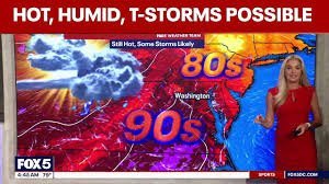
If you are in the DMV area, it is time to keep a close eye on the sky and stay hydrated. A Severe Thunderstorm Watch has been issued for Washington, D.C., along with significant portions of Maryland and Virginia. As the region grapples with intense humidity and rising temperatures, residents are urged to prepare for volatile weather conditions.
The Heat is On: Heat Indexes Surpass 100°F
The current weather in DC is characterized by oppressive heat and high humidity. While official highs are hovering around 90°F, the actual “feel” is much more dangerous. Heat index values are expected to climb well over 100°F, creating a risk for heat-related illnesses.
In specific parts of Virginia, including Spotsylvania and Culpeper counties, a formal Heat Advisory is in effect. In these areas, the heat index could soar as high as 109°F. To stay safe, the CDC recommends drinking plenty of fluids, remaining in air-conditioned environments, and avoiding direct sun exposure during peak hours.
Severe Thunderstorm Watch: When to Seek Shelter
While the afternoon may start with plenty of sunshine, a “backdoor cold front” is expected to trigger isolated but intense storms. According to the National Weather Service, the highest probability for showers and thunderstorms occurs between 2 p.m. and 5 p.m.
If you have outdoor plans or after-school events scheduled for Wednesday evening, it is highly recommended to have a backup indoor location ready. The atmosphere remains unstable, and the risk of severe weather persists throughout the day.
Who is Affected?
The weather alerts cover a broad region, including:
- n
- District of Columbia: Entirety of the city.
- Maryland: Including Baltimore City and counties such as Montgomery, Prince George’s, and Anne Arundel.
- Virginia: Including Fairfax, Arlington, Loudoun, Prince William, and several independent cities like Alexandria and Manassas.
Looking Ahead: The Weekend Forecast
The heat isn’t disappearing immediately. Thursday is expected to mirror Wednesday, with temperatures staying in the 90s and a continued chance of daily storms. However, there is a silver lining for those planning holiday getaways.
Conditions are expected to clear up just in time for the holiday weekend. We can look forward to drier weather and more comfortable highs in the 80s through Monday, making it a perfect window for outdoor celebrations.
Stay safe, stay cool, and keep monitoring your local weather updates!



