
Cleveland Weather Update: From Gray Skies to a Sunny Window and Weekend Storms
If you woke up to a gloomy, unsettled Thursday in Northeast Ohio, don’t let the gray skies fool you. The Cleveland weather is shifting, and while the start was slow, a much more comfortable pattern is moving in. Whether you are heading to a ballgame or planning a weekend getaway, here is everything you need to know about the coming days.
Thursday & Friday: The Window of Sunshine
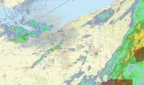
Thursday began with uneven rainfall, leaving southern communities like Akron and Canton soaked while the lakeshore areas saw only spotty showers. However, the clouds are expected to break, giving way to brighter conditions.
For sports fans, there is good news: although a passing shower might coincide with the first pitch of the Guardians’ game at Progressive Field, steady rain is not expected, and conditions will improve as the game progresses.
- n
- Thursday Evening: Expect a refreshing breeze from the north, clearing skies, and temperatures dropping into the 50s inland and 60s near Lake Erie.
- Friday’s Outlook: This is your prime window for outdoor activities! High pressure will bring abundant sunshine and comfortable humidity, with temperatures climbing to a pleasant 80°F.
Saturday: Watch Out for Potential Storms
The calm won’t last forever. By Saturday, the weather takes a turn as a cold front approaches from the west. While the morning should start dry, clouds will increase, leading to scattered showers and thunderstorms by the afternoon.
According to the Storm Prediction Center, Northeast Ohio is currently under a marginal risk (Level 1) for severe weather. While most storms will be isolated, keep an eye out for:
- n
- Damaging wind gusts.
- Potential hail.
- Locally heavy downpours.
Sunday and Beyond: A Cooler Shift
Following the cold front, a cooler air mass will settle over the region on Sunday. While temperatures will still reach the mid-70s, a northwest breeze will make it feel crisper, especially in the snowbelt east of Cleveland.
Coastal Alert: The interaction between cool air and the warm waters of Lake Erie may trigger lake-enhanced showers in Ashtabula, Geauga, and Lake counties. Additionally, waves between 2 to 4 feet are expected, which may lead to beach hazard statements due to dangerous currents.
Quick Forecast Summary
| Day | Expected Weather | Temp High |
|---|---|---|
| Friday | Sunny & Dry | ~80°F |
| Saturday | PM Thunderstorms | Upper 70s |
| Sunday | Cooler/Lake Showers | Mid 70s |
| Monday | Dry & Clear | 70s |
For the most up-to-the-minute alerts, we recommend monitoring the National Weather Service in Cleveland. Stay safe and enjoy the sunshine while it lasts!



