
The Unseen Crisis: Monitoring European River Drought via Space
In recent years, Europe has faced an unprecedented environmental challenge: severe water scarcity. While we often hear about heatwaves in the news, the true extent of the crisis is most vividly captured from above. European river drought satellite images have become indispensable tools for scientists and policymakers, providing a bird’s-eye view of a landscape struggling to survive.
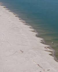
From the Rhine to the Po, the visual evidence provided by orbiting satellites reveals a sobering reality. The shrinking of riverbeds and the drying of wetlands are no longer just statistics; they are visible scars on the earth’s surface.
How Satellite Technology Tracks Water Stress
Monitoring a continent-wide drought requires more than just ground sensors. Space agencies utilize advanced remote sensing technology to detect changes in moisture levels and water volume. The primary tools used include:
- n
- Multi-spectral Imaging: These sensors capture light wavelengths that the human eye cannot see, allowing experts to distinguish between healthy vegetation and water-stressed crops.
- Altimetry: Satellites can measure the precise height of water levels in major rivers, identifying critical drops that threaten navigation and drinking water supplies.
- Thermal Infrared Sensors: By monitoring land surface temperature, satellites can pinpoint areas where the lack of water is causing extreme heat islands.
A primary source of this data is the Copernicus Programme, the European Union’s Earth observation initiative, which provides open-access data to help combat climate change.
The Most Affected Arteries of Europe
Satellite imagery has highlighted several critical areas where the drought has reached alarming levels:
The Rhine River
As one of Europe’s most important commercial waterways, the Rhine’s declining levels have led to economic disruptions. Satellite images show narrowed channels, forcing ships to carry lighter loads to avoid grounding.
The Po Valley
In Italy, the Po River has seen historic lows. Imagery reveals a drastic reduction in water flow, impacting agricultural productivity in one of the most fertile regions of Europe.
The Danube Basin
The Danube, which flows through multiple countries, shows signs of severe stress in its lower reaches, affecting biodiversity and the delicate balance of the Black Sea ecosystem.
Why This Matters: Beyond the Imagery
The data gathered from European river drought satellite images isn’t just for academic study; it has real-world implications for global stability. When major rivers dry up, the consequences ripple through several sectors:
- n
- Energy: Many European countries rely on hydroelectric power; low water levels mean less energy production.
- Agriculture: Without sufficient river water for irrigation, crop yields plummet, leading to higher food prices.
- Biodiversity: Aquatic species and riverside habitats are destroyed as water temperatures rise and oxygen levels drop.
For further reading on how global climate patterns influence these events, the NASA Climate portal offers extensive research on the connection between atmospheric warming and terrestrial water loss.
Conclusion: A Call for Sustainable Water Management
The clarity provided by satellite technology leaves no room for denial. The European river drought is a symptom of a larger planetary fever. By leveraging this data, Europe can implement better water management strategies, invest in drought-resistant infrastructure, and move toward a more sustainable future.
The images from space serve as a warning: the water that sustains our civilizations is finite, and the time to protect it is now.



