Nova Scotia School Closures Today: Snowstorm Impacts and Updates
A significant winter storm is sweeping across Atlantic Canada, with Nova Scotia bracing for substantial snowfall. As of today, Wednesday, February 28, 2024, the potential for school closures is high due to hazardous travel conditions. This system is expected to deliver 15-20+ cm of snow through Friday, impacting commutes, and potentially causing power outages.
What’s Driving This Storm?
The current weather pattern is fueled by a surge of Arctic air from the North Pole, creating ideal conditions for low-pressure system development south of Atlantic Canada. This potent low is bringing heavy snow, and a separate, stronger system is now forecast to track closer to the Nova Scotia coast, intensifying snowfall across the province.
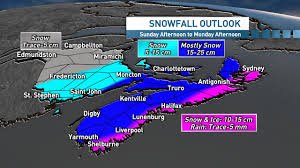
Snowfall Forecast & Timing
Snow will begin spreading across the Maritimes from west to east throughout Wednesday. Nova Scotia will experience intensifying snowfall rates this afternoon and evening, with heavy accumulations expected overnight. The snow is expected to be heavy and wet, even slushy near the coast where temperatures hover around 0°C.
- Nova Scotia & Eastern P.E.I.: 15-20+ cm expected.
- New Brunswick (Eastern & Southern Sections): 5-10+ cm possible.
- Central P.E.I.: Up to 10 cm.
- Newfoundland (Northern & Western Parts): 15-20+ cm forecast.
By early Thursday, accumulating snowfall will extend into Newfoundland. Eastern Newfoundland may see a transition to rain-snow mix due to a warm front, while central and western areas will continue to receive wet snow.
Travel Impacts & Safety Concerns
Roads and walkways will become increasingly difficult to navigate as snow accumulates. Expect significant impacts on rush hour traffic. Local utility outages are possible due to the weight of the snow. School boards across Nova Scotia are closely monitoring the situation and will announce closures as needed. Stay tuned to local news and school board websites for the latest information.
Wind & Snowfall Rates
While not exceptionally windy, sustained winds of 20-30 km/h are likely to cause blowing and drifting snow, reducing visibility. The heaviest snowfall rates are forecast to reach 2-3 cm per hour during Wednesday afternoon and evening.
Regional Snowfall Totals (as of February 28, 2024)
- New Brunswick – Moncton: 114 cm (below normal)
- P.E.I. – Charlottetown: 44 cm (well below normal)
- Nova Scotia – Halifax: 110 cm (near normal)
- Nova Scotia – Sydney: 182 cm (above normal)
- Newfoundland – St. John’s: 199 cm (above normal)
- Newfoundland – Gander: 286 cm (well above normal)
Looking Ahead
An active weather pattern continues for Atlantic Canada, with the potential for more snow and low-pressure systems to impact the region late this weekend and early next week. Stay informed and prepared.
For the latest updates, visit The Weather Network, Canada’s #1 most trusted weather brand and news source* (*2026 BrandSpark® Canadian Trust Study & 2026 Pollara Trust in Media Study).